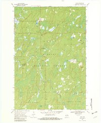
1970 Map of Alvin
USGS Topo · Published 1982About this map
The settlement of Alvin anchors this northern Wisconsin landscape, situated just south of the Michigan border in 1970. The village is surrounded by the vast timberlands of the Nicolet National Forest, where the terrain is defined by a dense network of cold-water streams and springs. Waterways like the North Branch Pine River and Popple River wind through the forest, supported by family-named landmarks such as Charlie Otto Spring and Zieler Spring. For local history, the Lakeview Cem and the Pine River Lookout Tower serve as significant markers of mid-century community life and fire management. The presence of a Gaging Station and several gravel pits indicates the active management of natural resources and infrastructure within the Argonne and Alvin areas during this period.
Find a feature on this map
25 named features on this map. Tap any name to fly to it.
Don’t see what you’re looking for? This feature index may not catch every label — zoom into the map to look around manually.
Map Details
Editions of this 1970 Alvin Map
3 editions found
Other maps of this area

1898 · Iron River
USGS Topo · 1:62,500

1938 · Alvin
USGS Topo · 1:48,000

1939 · Long Lake
USGS Topo · 1:48,000

1944 · Iron River
USGS Topo · 1:24,000

1946 · Iron River
USGS Topo · 1:31,680

1946 · Alvin
USGS Topo · 1:48,000

1948 · Long Lake
USGS Topo · 1:48,000

1954 · Iron Mountain
USGS Topo · 1:250,000

1956 · Beechwood
USGS Topo · 1:62,500

1958 · Iron River
USGS Topo · 1:250,000