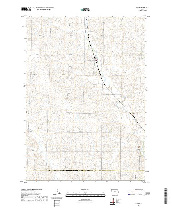
2022 Map of Alvord
USGS Topo · Published 2022About this map
Alvord serves as the central hub of this agricultural landscape in northwestern Iowa, where a grid of section-line roads such as Dipper Ave and 200th St organizes the fertile plains. The settlement is anchored by Saint Marys Cem near its western edge, while the surrounding countryside is defined by the winding paths of Mud Creek and Lizard Cr.
Find a feature on this map
38 named features on this map. Tap any name to fly to it.
Don’t see what you’re looking for? This feature index may not catch every label — zoom into the map to look around manually.
Map Details
Editions of this 2022 Alvord Map
This is the sole edition of this map. No revisions or reprints were ever made.
Other maps of this area

1955 · Sioux Falls
USGS Topo · 1:250,000

1958 · Sioux Falls
USGS Topo · 1:250,000

1964 · Hull
USGS Topo · 1:24,000

1968 · Fairview
USGS Topo · 1:24,000
1968 · Rock Valley
USGS Topo · 1:24,000

1971 · Lester
USGS Topo · 1:24,000
1971 · Inwood
USGS Topo · 1:24,000
1971 · Larchwood
USGS Topo · 1:24,000

1971 · Rock Rapids
USGS Topo · 1:24,000

1971 · Doon
USGS Topo · 1:24,000