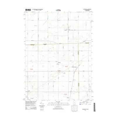
2013 Map of Alvordton
USGS Topo · Published 2013About this map
Waldron, Michigan, and Alvordton, Ohio, anchor this 2013 survey of the interstate borderlands where Hillsdale, Williams, and Fulton counties meet. The landscape is defined by its agrarian roots and small-town junctions, connected by a network of historic roads like Territorial Rd and Waldron Rd. The drainage of the E Br Saint Joseph River and Bird Cr winds through the northern sections, while the southern reaches feature Harrison Lake and the settlement of Kunkle.
Find a feature on this map
102 named features on this map. Tap any name to fly to it.
Don’t see what you’re looking for? This feature index may not catch every label — zoom into the map to look around manually.
Map Details
Editions of this 2013 Alvordton Map
This is the sole edition of this map. No revisions or reprints were ever made.
Other maps of this area

1913 · Alvordton
USGS Topo · 1:62,500

1914 · Pioneer
USGS Topo · 1:62,500

1944 · Pioneer
USGS Topo · 1:62,500

1944 · Alvordton
USGS Topo · 1:62,500

1953 · Fort Wayne
USGS Topo · 1:250,000

1956 · Fort Wayne
USGS Topo · 1:250,000

1959 · Frontier
USGS Topo · 1:24,000

1959 · Archbold
USGS Topo · 1:24,000

1960 · Fayette
USGS Topo · 1:24,000
1961 · Pioneer
USGS Topo · 1:24,000