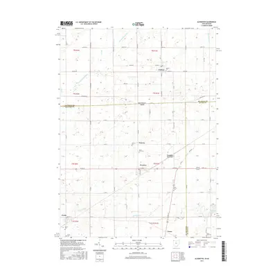
2016 Map of Alvordton
USGS Topo · Published 2016About this map
Waldron sits at the northern edge of this interstate borderlands survey, where the hills of southern Michigan meet the agricultural plains of northwest Ohio. The landscape is defined by its rural transit corridors and cemetery network, illustrating the long-standing community centers of Hillsdale and Fulton counties. Settlement clusters around local junctions like Alvordton and Primrose, while the drainage of the E Br Saint Joseph River and W Fork Mill Cr dictates the topography of the surrounding farmland.
Find a feature on this map
71 named features on this map. Tap any name to fly to it.
Don’t see what you’re looking for? This feature index may not catch every label — zoom into the map to look around manually.
Map Details
Editions of this 2016 Alvordton Map
This is the sole edition of this map. No revisions or reprints were ever made.
Other maps of this area

1913 · Alvordton
USGS Topo · 1:62,500

1914 · Pioneer
USGS Topo · 1:62,500

1944 · Pioneer
USGS Topo · 1:62,500

1944 · Alvordton
USGS Topo · 1:62,500

1953 · Fort Wayne
USGS Topo · 1:250,000

1956 · Fort Wayne
USGS Topo · 1:250,000

1959 · Frontier
USGS Topo · 1:24,000

1959 · Archbold
USGS Topo · 1:24,000

1960 · Fayette
USGS Topo · 1:24,000
1961 · Pioneer
USGS Topo · 1:24,000