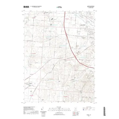
2019 Map of Amanda
USGS Topo · Published 2019About this map
The Hocking River flows through the northern reaches of this Fairfield County landscape, where the city of Lancaster transitions into a terrain defined by ridges and deep hollows. To the southeast, the dramatic topography of Jacobs Ladder and Christmas Rocks rises above Arney Run, marking a distinct shift from the more level lands near Amanda. The region is densely populated with small family and church burial grounds, including the Wesley Chapel Cem, Saint Thomas Cem, and the Stonewall Cem, providing a detailed record of the area's ancestral geography.
Find a feature on this map
138 named features on this map. Tap any name to fly to it.
Don’t see what you’re looking for? This feature index may not catch every label — zoom into the map to look around manually.
Map Details
Editions of this 2019 Amanda Map
This is the sole edition of this map. No revisions or reprints were ever made.
Other maps of this area

1907 · Lancaster
USGS Topo · 1:62,500

1907 · Thurston
USGS Topo · 1:62,500

1909 · Lancaster
USGS Topo · 1:62,500

1909 · Thurston
USGS Topo · 1:62,500

1914 · Circleville
USGS Topo · 1:62,500

1925 · East Columbus
USGS Topo · 1:62,500

1943 · Circleville
USGS Topo · 1:62,500

1943 · East Columbus
USGS Topo · 1:62,500

1947 · Columbus
USGS Topo · 1:250,000
1955 · Canal Winchester
USGS Topo · 1:24,000