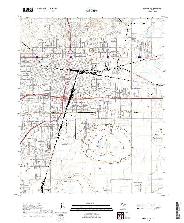
2022 Map of Amarillo East
USGS Topo · Published 2022About this map
Amarillo serves as the central hub of this High Plains landscape, where the urban grid is bisected by the Potter Co Randall Co line. The city's civic core is anchored by the Potter County Courthouse and the Potter County District Courts Building, reflecting its status as a regional center of governance and law. To the west, the neighborhood of San Jacinto sits near the banks of Amarillo Lake and Amarillo Cr, while the sprawling Llano Cem and the campus of Amarillo College dominate the south-central portion of the quadrangle. As the terrain moves toward the southern edge, the residential density of the city gives way to the more open character of Zita, illustrating the transition from the bustling city center to the surrounding agricultural plains.
Find a feature on this map
129 named features on this map. Tap any name to fly to it.
Don’t see what you’re looking for? This feature index may not catch every label — zoom into the map to look around manually.
Map Details
Editions of this 2022 Amarillo East Map
This is the sole edition of this map. No revisions or reprints were ever made.
Other maps of this area

1934 · Cliffside
USGS Topo · 1:62,500

1936 · Cliffside
USGS Topo · 1:62,500

1953 · Pleasant Valley
USGS Topo · 1:24,000

1953 · Mayer
USGS Topo · 1:24,000

1953 · Cliffside
USGS Topo · 1:24,000

1954 · Amarillo
USGS Topo · 1:250,000

1956 · Amarillo East
USGS Topo · 1:24,000

1956 · Thomas Ranch
USGS Topo · 1:24,000

1956 · Pullman
USGS Topo · 1:24,000

1958 · Amarillo
USGS Topo · 1:250,000