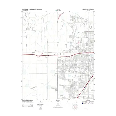
2012 Map of Amarillo West
USGS Topo · Published 2012About this map
The community of Soncy anchors the western expansion of Amarillo in this 2012 survey, illustrating the rapid conversion of High Plains ranch land into a complex network of suburban developments. North of the heavy infrastructure, the terrain remains defined by the winding course of W Amarillo Cr and the presence of the Kiwanis Camp, where the landscape transitions into a series of distinctive trails such as Dripping Springs Trl and Mackenzie Trl. The road names themselves, from Old Mill Rd to N Girl Scout Rd, hint at the area's transition from rural utility to residential recreation. Long-standing thoroughfares like Helium Rd and Indian Hill Rd provide a structural grid that organizes the newer subdivisions against the backdrop of the Texas Panhandle's expansive geography.
Find a feature on this map
280 named features on this map. Tap any name to fly to it.
Don’t see what you’re looking for? This feature index may not catch every label — zoom into the map to look around manually.
Map Details
Editions of this 2012 Amarillo West Map
This is the sole edition of this map. No revisions or reprints were ever made.
Other maps of this area

1934 · Ady
USGS Topo · 1:62,500

1934 · Cliffside
USGS Topo · 1:62,500

1936 · Cliffside
USGS Topo · 1:62,500

1936 · Ady
USGS Topo · 1:62,500

1953 · Pleasant Valley
USGS Topo · 1:24,000

1953 · Cliffside
USGS Topo · 1:24,000

1954 · Tucumcari
USGS Topo · 1:250,000

1954 · Amarillo
USGS Topo · 1:250,000

1956 · Amarillo East
USGS Topo · 1:24,000

1958 · Amarillo
USGS Topo · 1:250,000