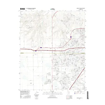
2016 Map of Amarillo West
USGS Topo · Published 2016About this map
Potter Co and Randall Co meet along a line of rapid suburban expansion in this modern survey of the Texas Panhandle. The landscape transitions from the residential developments of Soncy to the more open, undulating terrain of the northwest, where W Amarillo Cr carves through the plains toward Ranch Rd 1061. The southern portion of the map is dominated by the grid of the High Plains, notably around Spring Draw, while the urban infrastructure is defined by the heavy transit corridors of W Amarillo Blvd and Canyon Dr. This survey captures the modern road network as it interfaces with the older ranching lands of the High Plains, showing how thoroughfares like S Loop 335 W and Wolflin Ave provide the framework for the city's western growth into once-empty range land.
Find a feature on this map
36 named features on this map. Tap any name to fly to it.
Don’t see what you’re looking for? This feature index may not catch every label — zoom into the map to look around manually.
Map Details
Editions of this 2016 Amarillo West Map
This is the sole edition of this map. No revisions or reprints were ever made.
Other maps of this area

1934 · Ady
USGS Topo · 1:62,500

1934 · Cliffside
USGS Topo · 1:62,500

1936 · Cliffside
USGS Topo · 1:62,500

1936 · Ady
USGS Topo · 1:62,500

1953 · Pleasant Valley
USGS Topo · 1:24,000

1953 · Cliffside
USGS Topo · 1:24,000

1954 · Tucumcari
USGS Topo · 1:250,000

1954 · Amarillo
USGS Topo · 1:250,000

1956 · Amarillo East
USGS Topo · 1:24,000

1958 · Amarillo
USGS Topo · 1:250,000