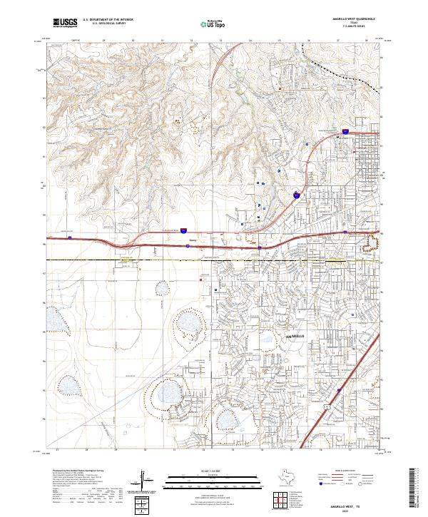
2023 Map of Amarillo West
USGS Topo · Published 2023About this map
Amarillo's westward expansion dominates this contemporary landscape, where the suburban grid meets the high plains breaks. The interface between intensive residential development and the natural drainages of West Amarillo Creek and Spring Draw reveals how modern infrastructure adapts to the local topography. Notable landmarks include the Saint Peters Episcopal Church Columbarium in the northern sector and the busy corridors of W Amarillo Blvd and Wolflin Ave. The map also captures the transition between Potter and Randall counties, marked by the distinctive settlement of Soncy. This survey provides a precise record of the road networks and commercial hubs, like those along Western Plaza Dr, that define the city's modern edge near Indian Hill Rd.
Find a feature on this map
42 named features on this map. Tap any name to fly to it.
Don’t see what you’re looking for? This feature index may not catch every label — zoom into the map to look around manually.
Map Details
Editions of this 2023 Amarillo West Map
This is the sole edition of this map. No revisions or reprints were ever made.
Other maps of this area

1934 · Ady
USGS Topo · 1:62,500

1934 · Cliffside
USGS Topo · 1:62,500

1936 · Cliffside
USGS Topo · 1:62,500

1936 · Ady
USGS Topo · 1:62,500

1953 · Pleasant Valley
USGS Topo · 1:24,000

1953 · Cliffside
USGS Topo · 1:24,000

1954 · Tucumcari
USGS Topo · 1:250,000

1954 · Amarillo
USGS Topo · 1:250,000

1956 · Amarillo East
USGS Topo · 1:24,000

1958 · Amarillo
USGS Topo · 1:250,000