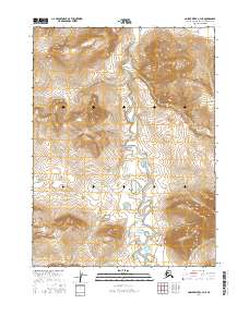
2016 Map of Ambler River C-4 NE
USGS Topo · Published 2016About this map
Amakomanak Creek meanders through the central corridor of this landscape, a remote section of the Alaskan wilderness situated within the Noatak National Preserve. The terrain is defined by the sharp transition between the low-lying wetlands surrounding the creek and the rising topographic elevations of the surrounding ranges. This 2016 survey illustrates the pristine environmental character of the Arctic region, where the primary human identifiers are the grid lines of the Public Land Survey System, such as t27n r5e and t26n r6e. The lack of infrastructure or named settlements underscores the preserve's role in protecting one of North America's most intact ecosystems.
Find a feature on this map
6 named features on this map. Tap any name to fly to it.
Don’t see what you’re looking for? This feature index may not catch every label — zoom into the map to look around manually.
Map Details
Editions of this 2016 Ambler River C-4 NE Map
This is the sole edition of this map. No revisions or reprints were ever made.
Other maps of this area

1951 · Ambler River
USGS Topo · 1:250,000

1956 · Ambler River
USGS Topo · 1:250,000

1964 · Ambler River
USGS Topo · 1:250,000
1990 · Ambler River D-4
USGS Topo · 1:63,360
1990 · Ambler River C-4
USGS Topo · 1:63,360
1990 · Ambler River D-3
USGS Topo · 1:63,360
1990 · Ambler River C-3
USGS Topo · 1:63,360
2015 · Ambler River C-4 SW
USGS Topo · 1:25,000
2016 · Ambler River C-3 SW
USGS Topo · 1:25,000
2016 · Ambler River D-4 SE
USGS Topo · 1:25,000