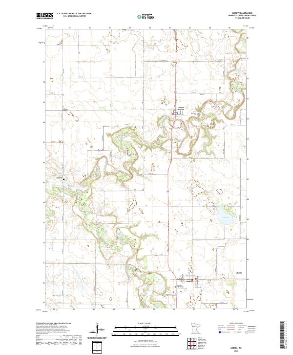
2022 Map of Amboy
USGS Topo · Published 2022About this map
Amboy and Vernon Center anchor this portion of Blue Earth County, where the meandering course of the Blue Earth River dictates the layout of the rural landscape. The river’s winding path is traced by the Blue Earth River Trl, cutting through a region defined by agricultural utility and small-town community centers. Significant local landmarks include the Saint Paul Evangelical Lutheran Cem near Amboy and the Vernon Center Cem overlooking the river valley, providing essential reference points for genealogists and local historians studying the area's late 19th and early 20th-century roots.
Find a feature on this map
18 named features on this map. Tap any name to fly to it.
Don’t see what you’re looking for? This feature index may not catch every label — zoom into the map to look around manually.
Map Details
Editions of this 2022 Amboy Map
This is the sole edition of this map. No revisions or reprints were ever made.
Other maps of this area

1951 · Mankato West
USGS Topo · 1:62,500

1953 · New Ulm
USGS Topo · 1:250,000

1954 · Fairmont
USGS Topo · 1:250,000

1957 · New Ulm
USGS Topo · 1:250,000

1958 · New Ulm
USGS Topo · 1:250,000

1958 · Fairmont
USGS Topo · 1:250,000

1965 · Perth
USGS Topo · 1:24,000

1967 · New Ulm
USGS Topo · 1:250,000

1967 · Truman SE
USGS Topo · 1:24,000

1967 · Winnebago
USGS Topo · 1:24,000