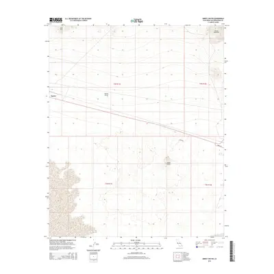
2015 Map of Amboy Crater
USGS Topo · Published 2015About this map
Amboy Crater dominates the southern landscape of this Mojave Desert region, surrounded by a complex field of basaltic flows and cinder cones. The terrain transitions from the volcanic deposits of the Lava Hills in the northwest to the southern reaches of the Bristol Mountains in the northeast. This portion of the Mojave Desert is bisected by the historic path of the former settlement of Bagdad, a site once critical to the rail operations in the arid San Bernardino County interior. Transport across this sparsely populated section of the desert is facilitated by Amboy Rd and the unpaved Crater Rd, which provide access to the prominent volcanic landmarks. The map details the Township and Range system, including t6n r11e and t5n r11e, illustrating the vast, surveyed parcels that characterize this segment of the California desert.
Find a feature on this map
11 named features on this map. Tap any name to fly to it.
Don’t see what you’re looking for? This feature index may not catch every label — zoom into the map to look around manually.
Map Details
Editions of this 2015 Amboy Crater Map
This is the sole edition of this map. No revisions or reprints were ever made.
Other maps of this area

1942 · Amboy
USGS Topo · 1:250,000

1943 · Amboy
USGS Topo · 1:250,000

1954 · Needles
USGS Topo · 1:250,000

1954 · Bristol Lake NW
USGS Topo · 1:24,000

1954 · Amboy Crater
USGS Topo · 1:24,000

1954 · Bagdad SW
USGS Topo · 1:24,000

1955 · Lead Mountain
USGS Topo · 1:24,000

1955 · Lead Mtn. NE
USGS Topo · 1:24,000

1955 · Lead Mountain
USGS Topo · 1:62,500

1956 · Needles
USGS Topo · 1:250,000