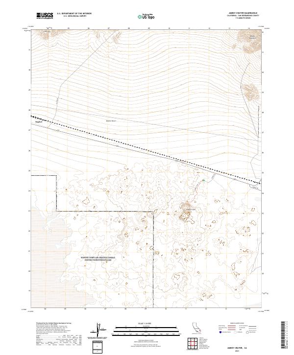
2021 Map of Amboy Crater
USGS Topo · Published 2021About this map
Amboy Crater dominates the southern landscape of this San Bernardino County survey, surrounded by an expansive field of volcanic features within the Mojave Desert. The map records a stark transition between the volcanic formations of the Lava Hills to the northwest and the rising slopes of the Bristol Mountains in the northeast. The central portion of the sheet is bisected by the historic alignment of Route 66, which runs parallel to the railroad through the site of Bagdad. This settlement, once a significant watering stop for the railroad in the arid desert environment, is shown here in its modern context. Transportation infrastructure remains a primary feature of the area, with Amboy Rd and Crater Rd providing access to the geologic landmarks, including the managed Amboy Crater Trl that leads visitors to the rim of the cinder cone.
Find a feature on this map
14 named features on this map. Tap any name to fly to it.
Don’t see what you’re looking for? This feature index may not catch every label — zoom into the map to look around manually.
Map Details
Editions of this 2021 Amboy Crater Map
This is the sole edition of this map. No revisions or reprints were ever made.
Other maps of this area

1942 · Amboy
USGS Topo · 1:250,000

1943 · Amboy
USGS Topo · 1:250,000

1954 · Needles
USGS Topo · 1:250,000

1954 · Bristol Lake NW
USGS Topo · 1:24,000

1954 · Amboy Crater
USGS Topo · 1:24,000

1954 · Bagdad SW
USGS Topo · 1:24,000

1955 · Lead Mountain
USGS Topo · 1:24,000

1955 · Lead Mtn. NE
USGS Topo · 1:24,000

1955 · Lead Mountain
USGS Topo · 1:62,500

1956 · Needles
USGS Topo · 1:250,000