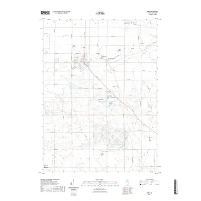
2021 Map of Amboy
USGS Topo · Published 2021About this map
The Green River meanders through the heart of Lee County, defining the agricultural and riparian landscape between the settlements of Amboy and Binghampton. This modern survey illustrates a region where local heritage is preserved in numerous burial grounds, including the centrally located Prairie Repose Cem and the Mormon Cem to the south. The southern portion of the map is dominated by the private recreational layout of Woodhaven Lake, surrounded by smaller water bodies like Black Oak Lake and Mallard Pond. Unique ecological zones such as Oak Glen Savanna, Earth Star Flats, and Spears Meadow suggest a diverse prairie and wetland environment. The transportation network is anchored by Us Rte 52 and aviation infrastructure at Taylor Airport, while the smaller community of Maytown sits near the southwestern corner, adjacent to Saint Patrick Cem.
Find a feature on this map
89 named features on this map. Tap any name to fly to it.
Don’t see what you’re looking for? This feature index may not catch every label — zoom into the map to look around manually.
Map Details
Editions of this 2021 Amboy Map
This is the sole edition of this map. No revisions or reprints were ever made.
Other maps of this area

1918 · Dixon
USGS Topo · 1:62,500

1950 · Dixon
USGS Topo · 1:62,500

1951 · Amboy
USGS Topo · 1:62,500

1952 · Rochelle
USGS Topo · 1:62,500

1952 · Mendota
USGS Topo · 1:62,500

1958 · Aurora
USGS Topo · 1:250,000

1961 · Aurora
USGS Topo · 1:250,000
1975 · Ashton
USGS Topo · 1:24,000
1982 · Ohio
USGS Topo · 1:24,000
1982 · Sublette
USGS Topo · 1:24,000