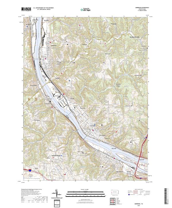
2023 Map of Ambridge
USGS Topo · Published 2023About this map
The Ohio River carves through the industrial heart of the Beaver and Allegheny county line, anchoring a dense network of valley settlements from Aliquippa to Coraopolis. This 2023 landscape illustrates the complex geography of the river towns, where steep hillsides overlook critical transport arteries like the P & L E RR and Ohio River Blvd. Cultural and educational institutions are prominent, with the campus of Robert Morris University in Carnot-Moon and the Trinity-Episcopal School for Ministry in Ambridge.
Find a feature on this map
91 named features on this map. Tap any name to fly to it.
Don’t see what you’re looking for? This feature index may not catch every label — zoom into the map to look around manually.
Map Details
Editions of this 2023 Ambridge Map
This is the sole edition of this map. No revisions or reprints were ever made.
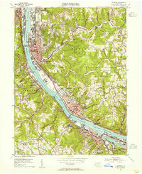
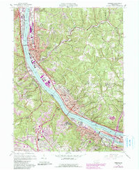
Historical Maps of Neville Township Through Time
3 maps found