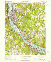
1953 Map of Ambridge
USGS Topo · Published 1955About this map
The Ohio River corridor serves as the industrial and transportation backbone of this region, where the Pennsylvania Railroad and the Pittsburgh and Lake Erie Railroad flank both banks. In Ambridge, the map highlights the Old Economy (Historical Site), preserving the communal history of the Harmony Society amidst a landscape of mid-century industrial growth. The river itself is a hive of activity, featuring the Dashields Dam, numerous riverside substations, and a Coast Guard Station Light near Osborne.
Find a feature on this map
88 named features on this map. Tap any name to fly to it.
Don’t see what you’re looking for? This feature index may not catch every label — zoom into the map to look around manually.
Map Details
Editions of this 1953 Ambridge Map
This is the sole edition of this map. No revisions or reprints were ever made.
Other maps of this area

1901 · Beaver
USGS Topo · 1:62,500

1904 · Beaver
USGS Topo · 1:62,500

1904 · Carnegie
USGS Topo · 1:62,500

1904 · Burgettstown
USGS Topo · 1:62,500

1906 · Burgettstown
USGS Topo · 1:62,500

1906 · Carnegie
USGS Topo · 1:62,500

1906 · Sewickley
USGS Topo · 1:62,500

1908 · Sewickley
USGS Topo · 1:62,500

1908 · Carnegie
USGS Topo · 1:62,500

1948 · Pittsburgh West
USGS Topo · 1:24,000