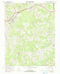
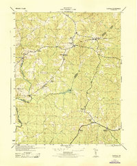
1966 Map of Amelia Court House
USGS Topo · Published 1991About this map
Amelia Court House serves as the focal point of this mid-1960s survey, where the Southern railroad line cuts through the Piedmont landscape of Amelia County. The settlement patterns revealed here emphasize a rural community anchored by numerous country churches, such as Little Bethel Ch, St Pauls Ch, and Tabernacle Ch. Educational sites including Amelia Academy and Russell Grove High Sch highlight the local social infrastructure alongside landmarks like the Fairground and Drive-in Theater.
Find a feature on this map
51 named features on this map. Tap any name to fly to it.
Don’t see what you’re looking for? This feature index may not catch every label — zoom into the map to look around manually.
Map Details
Editions of this 1966 Amelia Court House Map
Other maps of this area

1891 · Farmville
USGS Topo · 1:125,000

1893 · Farmville
USGS Topo · 1:125,000

1897 · Amelia
USGS Topo · 1:125,000

1943 · Amelia
USGS Topo · 1:31,680

1943 · Goodes Bridge
USGS Topo · 1:31,680

1943 · Clayville
USGS Topo · 1:24,000
1943 · Chula
USGS Topo · 1:24,000

1943 · Richmond
USGS Topo · 1:250,000

1944 · Chula
USGS Topo · 1:31,680
1944 · Clayville
USGS Topo · 1:31,680