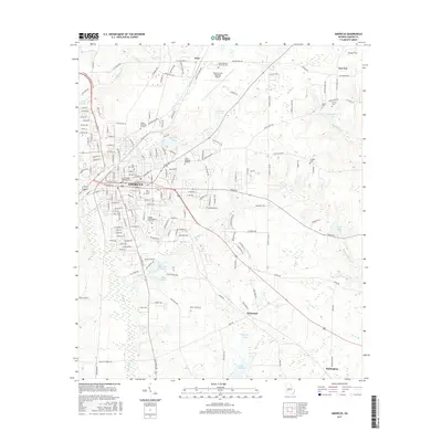
2017 Map of Americus
USGS Topo · Published 2017About this map
Americus serves as the central hub of this Georgia landscape, shown here in the 21st century as a well-developed regional center. The city's layout is defined by its educational and historical landmarks, ranging from Georgia Southwestern State Univ on the south side to numerous family and community burial grounds like Oak Grove Cem and Staley Memorial Gardens. To the north, Arles sits near the South Georgia Technical Coll and the Jimmy Carter Regional Airport, highlighting the area's importance as an aviation and technical gateway.
Find a feature on this map
174 named features on this map. Tap any name to fly to it.
Don’t see what you’re looking for? This feature index may not catch every label — zoom into the map to look around manually.
Map Details
Editions of this 2017 Americus Map
This is the sole edition of this map. No revisions or reprints were ever made.
Other maps of this area

1953 · Dothan
USGS Topo · 1:250,000

1954 · Dothan
USGS Topo · 1:250,000

1955 · Dothan
USGS Topo · 1:250,000

1955 · Phenix City
USGS Topo · 1:250,000

1956 · Leslie
USGS Topo · 1:62,500

1957 · Phenix City
USGS Topo · 1:250,000

1958 · Phenix City
USGS Topo · 1:250,000

1972 · Ellaville South
USGS Topo · 1:24,000
1972 · Methvins
USGS Topo · 1:24,000
1972 · Andersonville
USGS Topo · 1:24,000