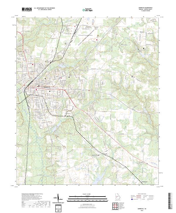
2024 Map of Americus
USGS Topo · Published 2024About this map
Americus serves as the regional hub for Sumter County, Georgia, shown here with its historic street grid and institutional anchors. The landscape is defined by the winding course of Muckalee Creek to the west and Town Creek flowing through the city center, while smaller outlying settlements like Arles and New Era dot the northern periphery. This survey highlights the intersection of local industry and public life, featuring the Sumter County Courthouse and Georgia Southwestern State University.
Find a feature on this map
193 named features on this map. Tap any name to fly to it.
Don’t see what you’re looking for? This feature index may not catch every label — zoom into the map to look around manually.
Map Details
Editions of this 2024 Americus Map
This is the sole edition of this map. No revisions or reprints were ever made.
Other maps of this area

1953 · Dothan
USGS Topo · 1:250,000

1954 · Dothan
USGS Topo · 1:250,000

1955 · Dothan
USGS Topo · 1:250,000

1955 · Phenix City
USGS Topo · 1:250,000

1956 · Leslie
USGS Topo · 1:62,500

1957 · Phenix City
USGS Topo · 1:250,000

1958 · Phenix City
USGS Topo · 1:250,000

1972 · Ellaville South
USGS Topo · 1:24,000
1972 · Methvins
USGS Topo · 1:24,000
1972 · Andersonville
USGS Topo · 1:24,000