
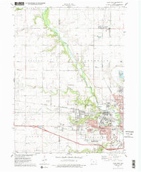
1975 Map of Ames West
USGS Topo · Published 1978About this map
Iowa State University anchor the landscape of this mid-1970s survey, showing the campus and its extensive Experimental Farms spreading westward into Washington and Franklin townships. The map documents the city of Ames as it expands toward the village of Ontario, while the Chicago and North Western railroad provides a rigid east-west axis through the terrain. To the north, the small settlements of Zenorsville and Gilbert remain distinct rural centers amidst a grid of section lines and field boundaries.
Find a feature on this map
52 named features on this map. Tap any name to fly to it.
Don’t see what you’re looking for? This feature index may not catch every label — zoom into the map to look around manually.
Map Details
Editions of this 1975 Ames West Map
2 editions found
Other maps of this area

1911 · Madrid
USGS Topo · 1:62,500

1911 · Slater
USGS Topo · 1:62,500

1912 · Ames
USGS Topo · 1:62,500

1913 · Slater
USGS Topo · 1:62,500

1914 · Madrid
USGS Topo · 1:62,500

1914 · Ames
USGS Topo · 1:62,500

1916 · Boone
USGS Topo · 1:62,500

1954 · Waterloo
USGS Topo · 1:250,000

1954 · Des Moines
USGS Topo · 1:250,000

1955 · Waterloo
USGS Topo · 1:250,000