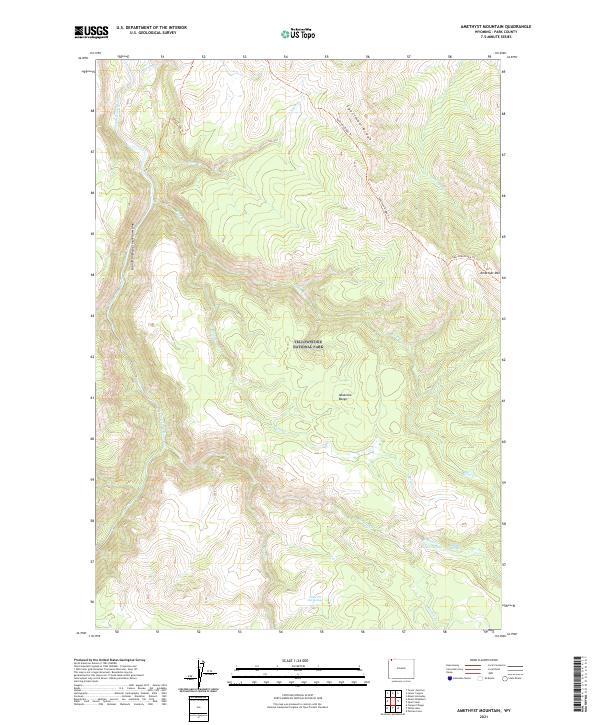
2021 Map of Amethyst Mountain
USGS Topo · Published 2021About this map
The Absaroka Range dominates this portion of Yellowstone National Park, defined by the dramatic descent into the Grand Canyon of the Yellowstone. This landscape is marked by hydrothermal activity and complex drainage patterns, where the Yellowstone River flows northward past the eastern edge of Specimen Ridge. The high-altitude terrain is accessible via the Specimen Ridge Trl and Agate Creek Trl, which provide routes through a series of named watercourses including Deep Cr and Amethyst Cr.
Find a feature on this map
26 named features on this map. Tap any name to fly to it.
Don’t see what you’re looking for? This feature index may not catch every label — zoom into the map to look around manually.
Map Details
Editions of this 2021 Amethyst Mountain Map
This is the sole edition of this map. No revisions or reprints were ever made.
Other maps of this area

1886 · Canyon
USGS Topo · 1:125,000

1895 · Canyon
USGS Topo · 1:125,000

1896 · Canyon
USGS Topo · 1:125,000

1901 · Canyon
USGS Topo · 1:125,000

1907 · Canyon
USGS Topo · 1:125,000

1911 · Canyon
USGS Topo · 1:125,000

1955 · Ashton
USGS Topo · 1:250,000

1958 · Ashton
USGS Topo · 1:250,000
1959 · Pelican Cone
USGS Topo · 1:62,500
1959 · Canyon Village
USGS Topo · 1:62,500