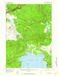
1959 Map of Canyon Village
USGS Topo · Published 1960About this map
The Yellowstone River carves through the heart of this mid-century survey, flowing from the north shore of Yellowstone Lake toward the dramatic Grand Canyon of the Yellowstone. The landscape is a complex network of thermal activity and early park infrastructure, centered around the hubs of Canyon Village and the hospitality facilities at Lake Lodge and Lake Hotel. These settlements were vital staging points for mid-century tourism, connected by the Grand Loop Road and several service routes.
Find a feature on this map
75 named features on this map. Tap any name to fly to it.
Don’t see what you’re looking for? This feature index may not catch every label — zoom into the map to look around manually.
Map Details
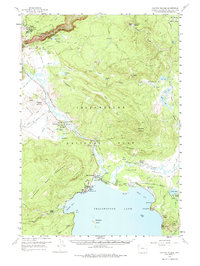
Editions of this 1959 Canyon Village Map
2 editions found
Other maps of this area

1885 · Lake
USGS Topo · 1:125,000

1885 · Gallatin
USGS Topo · 1:125,000

1885 · Gallatin
USGS Topo · 1:125,000

1886 · Shoshone
USGS Topo · 1:125,000

1886 · Canyon
USGS Topo · 1:125,000

1888 · Shoshone
USGS Topo · 1:125,000

1895 · Shoshone
USGS Topo · 1:125,000

1895 · Canyon
USGS Topo · 1:125,000

1895 · Lake
USGS Topo · 1:125,000

1896 · Lake
USGS Topo · 1:125,000