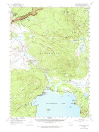
1959 Map of Canyon Village
USGS Topo · Published 1974About this map
Yellowstone National Park reveals its geothermal and geological complexity in this late 1950s survey, centered on the dramatic Grand Canyon of the Yellowstone. The map documents the development of tourist infrastructure during a period of significant park modernization, highlighting the planned layout of Canyon Village and the concentrated lodging at Lake Junction, including the Lake Hotel and Lake Lodge. The landscape is a dense network of thermal features, from the Basin Group in the north to the Mud Volcano and Dragons Mouth Spring near the river.
Find a feature on this map
82 named features on this map. Tap any name to fly to it.
Don’t see what you’re looking for? This feature index may not catch every label — zoom into the map to look around manually.
Map Details
Editions of this 1959 Canyon Village Map
2 editions found
Other maps of this area

1885 · Lake
USGS Topo · 1:125,000

1885 · Gallatin
USGS Topo · 1:125,000

1885 · Gallatin
USGS Topo · 1:125,000

1886 · Shoshone
USGS Topo · 1:125,000

1886 · Canyon
USGS Topo · 1:125,000

1888 · Shoshone
USGS Topo · 1:125,000

1895 · Shoshone
USGS Topo · 1:125,000

1895 · Canyon
USGS Topo · 1:125,000

1895 · Lake
USGS Topo · 1:125,000

1896 · Lake
USGS Topo · 1:125,000