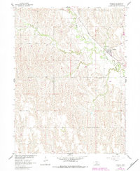
1961 Map of Amherst
USGS Topo · Published 1983About this map
Amherst serves as the focal point of this Buffalo County landscape, situated where the Union Pacific railroad corridor meets the winding course of the Wood River. The map, based on 1961 field data with 1980s-era revisions, illustrates the vital relationship between the rail line and the agricultural economy of the central Nebraska plains. Beyond the town grid, the terrain is marked by numerous wells, reflecting the region's reliance on groundwater for both domestic use and farming operations. The Stanley Cem lies to the southeast of the main settlement, providing a point of interest for genealogists tracing early families in the area. A significant Pipeline cuts across the center of the sheet, highlighting the modern infrastructure developments that emerged alongside the traditional rail and river routes in the mid-20th century.
Find a feature on this map
7 named features on this map. Tap any name to fly to it.
Don’t see what you’re looking for? This feature index may not catch every label — zoom into the map to look around manually.
Map Details
Editions of this 1961 Amherst Map
2 editions found
Other maps of this area

1894 · Kearney
USGS Topo · 1:62,500

1896 · Kearney
USGS Topo · 1:125,000

1955 · Grand Island
USGS Topo · 1:250,000

1957 · Grand Island
USGS Topo · 1:250,000

1958 · Grand Island
USGS Topo · 1:250,000

1961 · Elm Creek West
USGS Topo · 1:24,000

1961 · Amherst
USGS Topo · 1:24,000

1961 · Miller SW
USGS Topo · 1:24,000

1962 · Riverdale
USGS Topo · 1:24,000

1962 · Elm Creek East
USGS Topo · 1:24,000