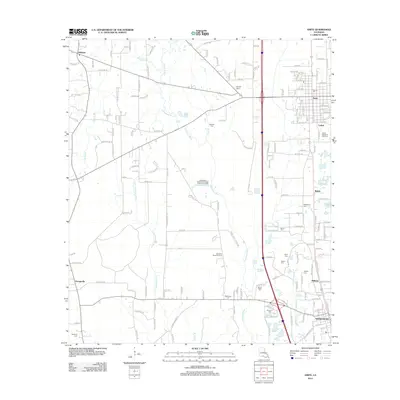
2012 Map of Amite
USGS Topo · Published 2012About this map
Independence and Amite anchor the eastern corridor of this Tangipahoa Parish landscape, where the Natalbany River and its various tributaries like the Little Natalbany River carve a path through the lowlands. The area's social fabric is visible through several family-named landmarks and cemeteries, including Bennett Cem, Sharkey Cem, and McMichael Cem. Settlement patterns are concentrated along the main thoroughfares, while the outlying regions maintain a mix of wooded areas and agricultural space. Notable community sites such as the Apostolic Camp Grounds and Bickham Chapel serve as local centers. The presence of the Tangipahoa Septic Tank Sludge Treatment Facility near the river indicates the modern infrastructure supporting these growing rural communities. Other distinct settlements like Gullett and Shiloh further define the local geography, providing a clear view of the parish's residential distribution.
Find a feature on this map
175 named features on this map. Tap any name to fly to it.
Don’t see what you’re looking for? This feature index may not catch every label — zoom into the map to look around manually.
Map Details
Editions of this 2012 Amite Map
This is the sole edition of this map. No revisions or reprints were ever made.
Other maps of this area

1940 · Tickfaw
USGS Topo · 1:31,680

1940 · Roseland
USGS Topo · 1:31,680

1942 · Roseland
USGS Topo · 1:31,680

1942 · Montpelier
USGS Topo · 1:31,680

1942 · Loranger
USGS Topo · 1:31,680

1949 · Bolivar
USGS Topo · 1:31,680

1949 · Amite
USGS Topo · 1:31,680

1949 · Albany
USGS Topo · 1:31,680

1950 · Doyle
USGS Topo · 1:31,680

1950 · Greensburg
USGS Topo · 1:31,680