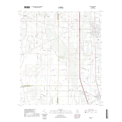
2018 Map of Amite
USGS Topo · Published 2018About this map
Amite and Independence serve as the primary anchors for this region of Tangipahoa Parish, where the local landscape is defined by the parallel courses of the Natalbany River and Little Natalbany River. Small settlements such as Gullett, Shiloh, and Hillsdale appear alongside a significant collection of family and community burial grounds, including Sharkey Cem, McMichael Cem, and Baham Cem. The mapping shows a distinct transition where the northern grid of Amite gives way to the more dispersed rural reaches near Georgeville and the parish lines with St. Helena and Livingston. Waterways like Ponchatoula Cr and Morgan Br drain the timbered and agricultural lands between these established towns, reflecting the traditional drainage patterns that have guided settlement in this part of Louisiana for generations.
Find a feature on this map
137 named features on this map. Tap any name to fly to it.
Don’t see what you’re looking for? This feature index may not catch every label — zoom into the map to look around manually.
Map Details
Editions of this 2018 Amite Map
This is the sole edition of this map. No revisions or reprints were ever made.
Other maps of this area

1940 · Tickfaw
USGS Topo · 1:31,680

1940 · Roseland
USGS Topo · 1:31,680

1942 · Roseland
USGS Topo · 1:31,680

1942 · Montpelier
USGS Topo · 1:31,680

1942 · Loranger
USGS Topo · 1:31,680

1949 · Bolivar
USGS Topo · 1:31,680

1949 · Amite
USGS Topo · 1:31,680

1949 · Albany
USGS Topo · 1:31,680

1950 · Doyle
USGS Topo · 1:31,680

1950 · Greensburg
USGS Topo · 1:31,680