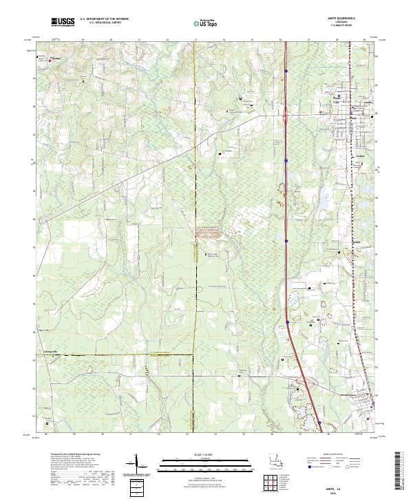
2024 Map of Amite
USGS Topo · Published 2024About this map
Amite City serves as a focal point for this region of Louisiana, anchored by the Tangipahoa Parish Courthouse and a grid of streets that extend into Amite. The landscape is defined by the drainage basins of the Natalbany River and the Little Natalbany River, which wind through a mosaic of forested and open land. To the north, the small settlement of Hillsdale and its Hillsdale Baptist Church mark a rural landscape of parish roads and family-named cemeteries.
Find a feature on this map
171 named features on this map. Tap any name to fly to it.
Don’t see what you’re looking for? This feature index may not catch every label — zoom into the map to look around manually.
Map Details
Editions of this 2024 Amite Map
This is the sole edition of this map. No revisions or reprints were ever made.
Other maps of this area

1940 · Tickfaw
USGS Topo · 1:31,680

1940 · Roseland
USGS Topo · 1:31,680

1942 · Roseland
USGS Topo · 1:31,680

1942 · Montpelier
USGS Topo · 1:31,680

1942 · Loranger
USGS Topo · 1:31,680

1949 · Bolivar
USGS Topo · 1:31,680

1949 · Amite
USGS Topo · 1:31,680

1949 · Albany
USGS Topo · 1:31,680

1950 · Doyle
USGS Topo · 1:31,680

1950 · Greensburg
USGS Topo · 1:31,680