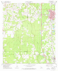
1974 Map of Amite
USGS Topo · Published 1978About this map
Amite serves as the focal point of this 1970s survey, showing its development as a parish center during a period of steady transition. The town's grid is dense with civic landmarks, including the Courthouse, Post Office, and City Hall, all situated near the Illinois Central Gulf railroad line. The surrounding landscape of Tangipahoa Parish and St. Helena Parish is characterized by numerous country churches and family burial grounds, such as Mother of Perpetual Help Ch and Sharkey Cem. The Natalbany River and Little River wind through the timber and agricultural lands, defining the drainage patterns of the region. Local education and community life are marked by sites like Oak Forest Academy and the Fifth Ward Sch, while the presence of several Gravel Pits points to the area's extractive industry alongside its rural settlements like Gullett and Hillsdale.
Find a feature on this map
58 named features on this map. Tap any name to fly to it.
Don’t see what you’re looking for? This feature index may not catch every label — zoom into the map to look around manually.
Map Details
Editions of this 1974 Amite Map
This is the sole edition of this map. No revisions or reprints were ever made.
Other maps of this area

1940 · Tickfaw
USGS Topo · 1:31,680

1940 · Roseland
USGS Topo · 1:31,680

1942 · Roseland
USGS Topo · 1:31,680

1942 · Montpelier
USGS Topo · 1:31,680

1942 · Loranger
USGS Topo · 1:31,680

1949 · Bolivar
USGS Topo · 1:31,680

1949 · Amite
USGS Topo · 1:31,680

1949 · Albany
USGS Topo · 1:31,680

1950 · Doyle
USGS Topo · 1:31,680

1950 · Greensburg
USGS Topo · 1:31,680