Loading...
Loading map...2021 Map of Amity
USGS Topo · Published 2021About this map
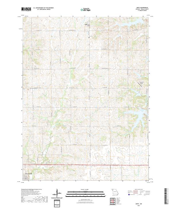
Amity and the northern reaches of Stewartsville anchor this DeKalb County landscape, where the agricultural grid is deeply etched by the winding course of Castile Cr. The terrain is defined by a dense network of sectional roads, including SW Frank Ross Rd and SW Grindstone Rd, which serve a territory dotted with rural homesteads and local landmarks like the Amity Cem.
Find a feature on this map
28 named features on this map. Tap any name to fly to it.
Don’t see what you’re looking for? This feature index may not catch every label — zoom into the map to look around manually.
Map Details
Date Portrayed2021
Date Published2021
PublisherU.S. Geological Survey
Map TypeTopographic
Scale1:24000
Physical Dimensions24 x 29 inches
Editions of this 2021 Amity Map
This is the sole edition of this map. No revisions or reprints were ever made.
Historical Maps of Camden Township Through Time
Featured Locations
- Sherman Township, MO
- Washington Township, MO
- Colfax Township, MO
- Amity, Camden Township
- Stewartsville, Washington Township
Source Details
SourceU.S. Geological Survey
CopyrightPublic Domain