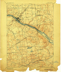
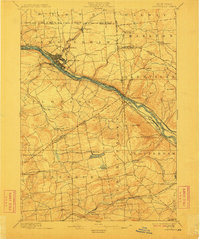
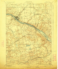
1895 Map of Amsterdam
USGS Topo · Published 1903About this map
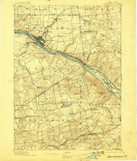
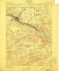
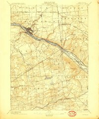
The Mohawk River valley serves as a bustling industrial and transportation corridor in this late 19th-century survey. The landscape is dominated by the parallel paths of the Erie Canal and competing rail lines, including the New York Central and Hudson River R.R. and the West Shore R.R.. This infrastructure anchors the growth of Amsterdam, which is shown with a detailed street grid and significant development on both sides of the river, connected by Port Jackson.
Find a feature on this map
61 named features on this map. Tap any name to fly to it.
Don’t see what you’re looking for? This feature index may not catch every label — zoom into the map to look around manually.
Map Details
Editions of this 1895 Amsterdam Map
7 editions found
Other maps of this area

1893 · Schenectady
USGS Topo · 1:62,500

1893 · Albany
USGS Topo · 1:62,500

1895 · Albany
USGS Topo · 1:62,500

1895 · Schenectady
USGS Topo · 1:62,500

1895 · Amsterdam
USGS Topo · 1:62,500

1896 · Fonda
USGS Topo · 1:62,500

1898 · Schenectady
USGS Topo · 1:62,500

1898 · Albany
USGS Topo · 1:62,500

1898 · Fonda
USGS Topo · 1:62,500

1898 · Schoharie
USGS Topo · 1:62,500