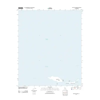
2012 Map of Anacapa Island
USGS Topo · Published 2012About this map
Anacapa Island and its smaller counterparts form a distinctive chain within the Santa Barbara Channel, as documented in this 2012 survey. The topography of the island group is defined by prominent landmarks such as Camel Peak on West Anacapa Island and the natural formation of Keyhole Rock off the eastern shores. Coastal access is noted at Frenchys Cove Beach, adjacent to the waters of Frenchys Cove. The map also identifies the seasonal or specialized settlement at East Fish Camp, located on the eastern tip of the chain near Middle Anacapa Island. Surrounded by the Pacific Ocean, these islands are separated from the mainland by the deep Anacapa Passage, illustrating the geographic isolation that has preserved their unique coastal character.
Find a feature on this map
12 named features on this map. Tap any name to fly to it.
Don’t see what you’re looking for? This feature index may not catch every label — zoom into the map to look around manually.
Map Details
Editions of this 2012 Anacapa Island Map
This is the sole edition of this map. No revisions or reprints were ever made.
Other maps of this area
1943 · Santa Cruz Island D
USGS Topo · 1:24,000

1949 · Los Angeles
USGS Topo · 1:250,000

1949 · Long Beach
USGS Topo · 1:250,000

1955 · Los Angeles
USGS Topo · 1:250,000

1957 · Long Beach
USGS Topo · 1:250,000

1958 · Long Beach
USGS Topo · 1:250,000

1959 · Los Angeles
USGS Topo · 1:250,000

1960 · Long Beach
USGS Topo · 1:250,000

1966 · Los Angeles
USGS Topo · 1:250,000
1975 · Los Angeles
USGS Topo · 1:250,000