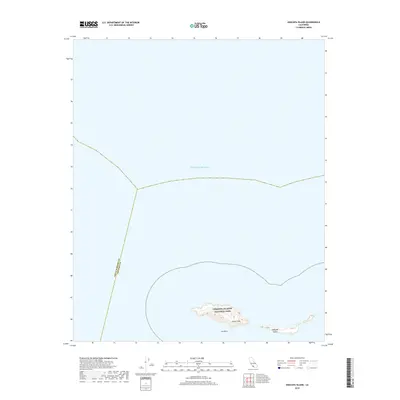
2018 Map of Anacapa Island
USGS Topo · Published 2018About this map
Anacapa Island sits within the protected boundaries of Channel Islands National Park, appearing here as a series of narrow, high ridges surrounded by the Pacific Ocean. This coastal landscape is dominated by notable topographical high points such as Camel Peak and the nearby landmark of Cat Rock at the water's edge. The map also delineates the offshore administrative boundary between Santa Barbara and Ventura counties, which bisects the open water to the west and north of the island chain. The survey highlights the isolation and preservation of this archipelago, showing it as it appeared in the late 2010s before any major natural shifts or modern management changes.
Find a feature on this map
6 named features on this map. Tap any name to fly to it.
Don’t see what you’re looking for? This feature index may not catch every label — zoom into the map to look around manually.
Map Details
Editions of this 2018 Anacapa Island Map
This is the sole edition of this map. No revisions or reprints were ever made.
Other maps of this area
1943 · Santa Cruz Island D
USGS Topo · 1:24,000

1949 · Los Angeles
USGS Topo · 1:250,000

1949 · Long Beach
USGS Topo · 1:250,000

1955 · Los Angeles
USGS Topo · 1:250,000

1957 · Long Beach
USGS Topo · 1:250,000

1958 · Long Beach
USGS Topo · 1:250,000

1959 · Los Angeles
USGS Topo · 1:250,000

1960 · Long Beach
USGS Topo · 1:250,000

1966 · Los Angeles
USGS Topo · 1:250,000
1975 · Los Angeles
USGS Topo · 1:250,000