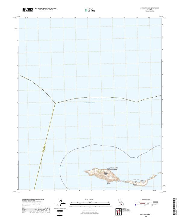
2021 Map of Anacapa Island
USGS Topo · Published 2021About this map
West Anacapa Island and Middle Anacapa Island emerge from the Pacific Ocean in this coastal survey of the Channel Islands National Park. The map documents the isolated chain's topography, highlighting local peaks and landmarks like Camel Peak and the distinctive Cat Rock. To the east, the island's coastline is punctuated by Frenchys Cove Beach and the prominent Keyhole Rock, offering a detailed look at these protected landforms. The maritime boundary between Santa Barbara and Ventura counties cuts through the Anacapa Passage, marking the administrative division across the open water. This 2021 study provides an accurate record of the island's elevations and shoreline features, essential for those studying the conservation and physical geography of the Anacapa Island chain.
Find a feature on this map
13 named features on this map. Tap any name to fly to it.
Don’t see what you’re looking for? This feature index may not catch every label — zoom into the map to look around manually.
Map Details
Editions of this 2021 Anacapa Island Map
This is the sole edition of this map. No revisions or reprints were ever made.
Other maps of this area
1943 · Santa Cruz Island D
USGS Topo · 1:24,000

1949 · Los Angeles
USGS Topo · 1:250,000

1949 · Long Beach
USGS Topo · 1:250,000

1955 · Los Angeles
USGS Topo · 1:250,000

1957 · Long Beach
USGS Topo · 1:250,000

1958 · Long Beach
USGS Topo · 1:250,000

1959 · Los Angeles
USGS Topo · 1:250,000

1960 · Long Beach
USGS Topo · 1:250,000

1966 · Los Angeles
USGS Topo · 1:250,000
1975 · Los Angeles
USGS Topo · 1:250,000