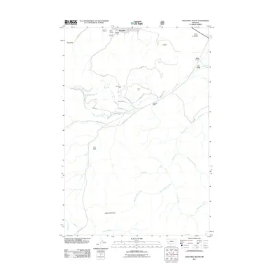
2011 Map of Anaconda South
USGS Topo · Published 2011About this map
The industrial footprint of the Anaconda Smelter dominates the northern portion of this landscape, where the southern edge of the city gives way to the high-elevation terrain of the Anaconda Range. This 2011 survey illustrates the complex relationship between mining operations and the natural topography, notably through the placement of the Smelter Tailings Ponds Dam and scattered historical workings like the Pennsylvania Mine and Alpha Mine. Along the lower slopes, the Upper Hill Cemetery, Mount Carmel Cemetery, and Lower Hill Cemetery represent the social and genealogical history of the mining community. The southern reaches of the map shift toward undeveloped wilderness, defined by major drainage systems such as Mill Creek and Willow Creek flowing from the slopes of Sugarloaf Mountain. A dense network of trails, including the Silver Creek Trl and Wapiti Trl, provides access to these remote canyons and retired mining sites.
Find a feature on this map
51 named features on this map. Tap any name to fly to it.
Don’t see what you’re looking for? This feature index may not catch every label — zoom into the map to look around manually.
Map Details
Editions of this 2011 Anaconda South Map
This is the sole edition of this map. No revisions or reprints were ever made.
Other maps of this area

1889 · Helena
USGS Topo · 1:250,000

1893 · Helena
USGS Topo · 1:250,000

1893 · Dillon
USGS Topo · 1:250,000

1899 · Helena
USGS Topo · 1:250,000

1903 · Helena
USGS Topo · 1:250,000

1908 · Philipsburg
USGS Topo · 1:125,000

1947 · Butte
USGS Topo · 1:250,000

1955 · Dillon
USGS Topo · 1:250,000

1957 · Dillon
USGS Topo · 1:250,000

1958 · Butte
USGS Topo · 1:250,000