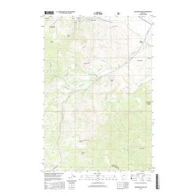
2017 Map of Anaconda South
USGS Topo · Published 2017About this map
Anaconda sits at the northern edge of this high-altitude landscape, where the urban grid gives way to the complex industrial and natural topography of the Pintler region. The map reveals a cluster of significant burial grounds including Upper Hill Cem, Mount Carmel Cem, and Lower Hill Cem, established near the historic smelting operations. A dense network of trails and roads, such as Alpha Lode Trl and the Anaconda Smelter Rd, winds through the gulches and foothills, reflecting a legacy of mineral exploration and transportation. Southward, the terrain rises sharply toward the Continental Divide, punctuated by the prominent peak of Sugarloaf Mtn. This area within the Deerlodge National Forest is defined by its drainage systems, with Mill Cr and Silver Cr carving through the mountain slopes, illustrating the transition from industrial settlement to protected wilderness.
Find a feature on this map
59 named features on this map. Tap any name to fly to it.
Don’t see what you’re looking for? This feature index may not catch every label — zoom into the map to look around manually.
Map Details
Editions of this 2017 Anaconda South Map
This is the sole edition of this map. No revisions or reprints were ever made.
Other maps of this area

1889 · Helena
USGS Topo · 1:250,000

1893 · Helena
USGS Topo · 1:250,000

1893 · Dillon
USGS Topo · 1:250,000

1899 · Helena
USGS Topo · 1:250,000

1903 · Helena
USGS Topo · 1:250,000

1908 · Philipsburg
USGS Topo · 1:125,000

1947 · Butte
USGS Topo · 1:250,000

1955 · Dillon
USGS Topo · 1:250,000

1957 · Dillon
USGS Topo · 1:250,000

1958 · Butte
USGS Topo · 1:250,000