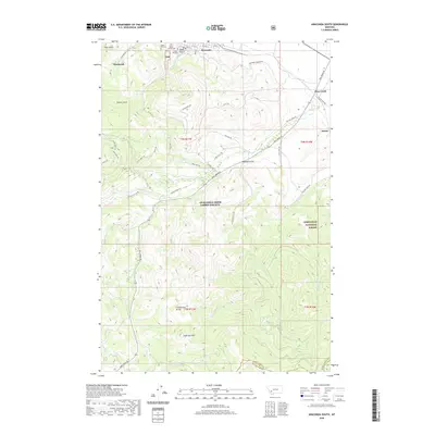
2020 Map of Anaconda South
USGS Topo · Published 2020About this map
The Anaconda southern periphery is defined by the steep elevation gains toward the Continental Divide and the sprawling Deerlodge National Forest. This 2020 landscape reveals the enduring community heritage of the area, anchored by a cluster of prominent burial grounds including Upper Hill Cem, Mount Carmel Cem, and Lower Hill Cem situated just south of the city core. The transition from industrial infrastructure to timbered wilderness is evidenced by roads like the Anaconda Smelter Rd leading away from the historical copper processing sites toward the high country. Deep in the southern half of the quadrangle, the terrain rises to Sugarloaf Mtn, with the drainage network of W Fork Willow Cr and Elk Cr carving through the forest. Small clusters of development at Sunnyside, Mine Creek, and Staton reflect the area's history of mining and transportation along the Mill Creek Rd corridor.
Find a feature on this map
60 named features on this map. Tap any name to fly to it.
Don’t see what you’re looking for? This feature index may not catch every label — zoom into the map to look around manually.
Map Details
Editions of this 2020 Anaconda South Map
This is the sole edition of this map. No revisions or reprints were ever made.
Other maps of this area

1889 · Helena
USGS Topo · 1:250,000

1893 · Helena
USGS Topo · 1:250,000

1893 · Dillon
USGS Topo · 1:250,000

1899 · Helena
USGS Topo · 1:250,000

1903 · Helena
USGS Topo · 1:250,000

1908 · Philipsburg
USGS Topo · 1:125,000

1947 · Butte
USGS Topo · 1:250,000

1955 · Dillon
USGS Topo · 1:250,000

1957 · Dillon
USGS Topo · 1:250,000

1958 · Butte
USGS Topo · 1:250,000