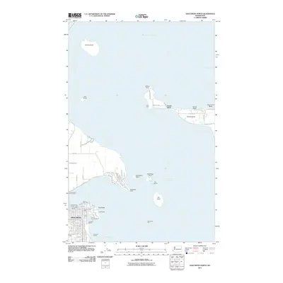
2011 Map of Anacortes North
USGS Topo · Published 2011About this map
Anacortes serves as the primary urban hub on this coastal sheet, situated at the edge of Fidalgo Bay and the northern reaches of Puget Sound. The map details the intricate maritime infrastructure of the city, including the Port of Anacortes, multiple marinas like Anchor Cove Marina, and the Anacortes Post Office. The waterfront is defined by industrial and recreational sites, from the prominent Cap Sante peninsula to the Guemes Island Ferry Landing and Anacortes Ferry Landing, which link the mainland to the surrounding archipelago.
Find a feature on this map
82 named features on this map. Tap any name to fly to it.
Don’t see what you’re looking for? This feature index may not catch every label — zoom into the map to look around manually.
Map Details
Editions of this 2011 Anacortes North Map
This is the sole edition of this map. No revisions or reprints were ever made.
Other maps of this area

1911 · Mount Vernon
USGS Topo · 1:125,000

1918 · Samish Lake
USGS Topo · 1:62,500

1940 · Mt Vernon
USGS Topo · 1:62,500

1943 · Mt Vernon
USGS Topo · 1:62,500

1943 · Deception Pass
USGS Topo · 1:62,500

1943 · Anacortes
USGS Topo · 1:62,500

1951 · Deception Pass
USGS Topo · 1:62,500

1951 · Anacortes
USGS Topo · 1:62,500

1954 · Bow
USGS Topo · 1:24,000
1954 · Bellingham South
USGS Topo · 1:24,000