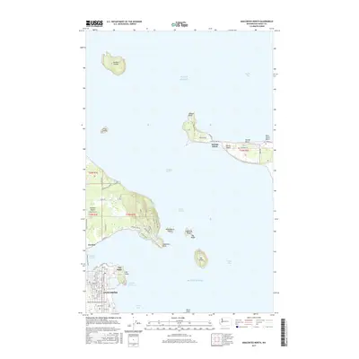
2017 Map of Anacortes North
USGS Topo · Published 2017About this map
Guemes Island Ferry routes connect the mainland at Anacortes to the rural community of Guemes across the Guemes Channel. This coastal landscape is defined by the scattered islands of the Puget Sound, including the high ground of Vendovi Island and the residential clusters along Samish Island. The street grid of northern Anacortes transitions into the prominent peninsula of Cap Sante, which overlooks the Cap Sante Waterway and the industrial infrastructure at March Point.
Find a feature on this map
88 named features on this map. Tap any name to fly to it.
Don’t see what you’re looking for? This feature index may not catch every label — zoom into the map to look around manually.
Map Details
Editions of this 2017 Anacortes North Map
This is the sole edition of this map. No revisions or reprints were ever made.
Other maps of this area

1911 · Mount Vernon
USGS Topo · 1:125,000

1918 · Samish Lake
USGS Topo · 1:62,500

1940 · Mt Vernon
USGS Topo · 1:62,500

1943 · Mt Vernon
USGS Topo · 1:62,500

1943 · Deception Pass
USGS Topo · 1:62,500

1943 · Anacortes
USGS Topo · 1:62,500

1951 · Deception Pass
USGS Topo · 1:62,500

1951 · Anacortes
USGS Topo · 1:62,500

1954 · Bow
USGS Topo · 1:24,000
1954 · Bellingham South
USGS Topo · 1:24,000