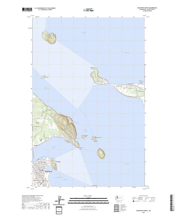
2023 Map of Anacortes North
USGS Topo · Published 2023About this map
Anacortes anchors the southern portion of this chart, where the city grid meets the deep waters of the Guemes Channel and Cap Sante Waterway. The landscape is defined by the complex coastline of the San Juan Islands, including the residential clusters on Guemes Island and the hook of Samish Island reaching into Samish Bay. The maritime character of the region is evident in the numerous protected coves like Deadman Bay and Cooks Cove, alongside the vital transit link provided by the Guemes Island Ferry.
Find a feature on this map
78 named features on this map. Tap any name to fly to it.
Don’t see what you’re looking for? This feature index may not catch every label — zoom into the map to look around manually.
Map Details
Editions of this 2023 Anacortes North Map
This is the sole edition of this map. No revisions or reprints were ever made.
Other maps of this area

1911 · Mount Vernon
USGS Topo · 1:125,000

1918 · Samish Lake
USGS Topo · 1:62,500

1940 · Mt Vernon
USGS Topo · 1:62,500

1943 · Mt Vernon
USGS Topo · 1:62,500

1943 · Deception Pass
USGS Topo · 1:62,500

1943 · Anacortes
USGS Topo · 1:62,500

1951 · Deception Pass
USGS Topo · 1:62,500

1951 · Anacortes
USGS Topo · 1:62,500

1954 · Bow
USGS Topo · 1:24,000
1954 · Bellingham South
USGS Topo · 1:24,000