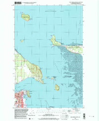
1998 Map of Anacortes North
USGS Topo · Published 2003About this map
Anacortes anchors this coastal survey, where the dense street grid of the city meets the intricate shoreline of Fidalgo Bay and Guemes Channel. The map documents a maritime landscape defined by its light stations, including Vendovi Island Light and William Point Light, which guided vessels through the complex waters of Bellingham Bay and Padilla Bay. On Guemes Island, the presence of Eden Cem and a network of rural routes like Edens Road suggest a quieter, residential character compared to the industrial and civic activity at the W T Preston Museum and Anacortes High Sch. Further north, Samish Island shows a mix of seasonal and permanent settlements at Samish Beach and the youth campgrounds of Camp Kirby. The surrounding tidal flats and islands, such as Saddlebag Island State Park, emphasize the area's importance as both a navigational gateway and a site for recreation and conservation.
Find a feature on this map
53 named features on this map. Tap any name to fly to it.
Don’t see what you’re looking for? This feature index may not catch every label — zoom into the map to look around manually.
Map Details
Editions of this 1998 Anacortes North Map
This is the sole edition of this map. No revisions or reprints were ever made.
Other maps of this area

1911 · Mount Vernon
USGS Topo · 1:125,000

1918 · Samish Lake
USGS Topo · 1:62,500

1940 · Mt Vernon
USGS Topo · 1:62,500

1943 · Mt Vernon
USGS Topo · 1:62,500

1943 · Deception Pass
USGS Topo · 1:62,500

1943 · Anacortes
USGS Topo · 1:62,500

1951 · Deception Pass
USGS Topo · 1:62,500

1951 · Anacortes
USGS Topo · 1:62,500

1954 · Bow
USGS Topo · 1:24,000
1954 · Bellingham South
USGS Topo · 1:24,000