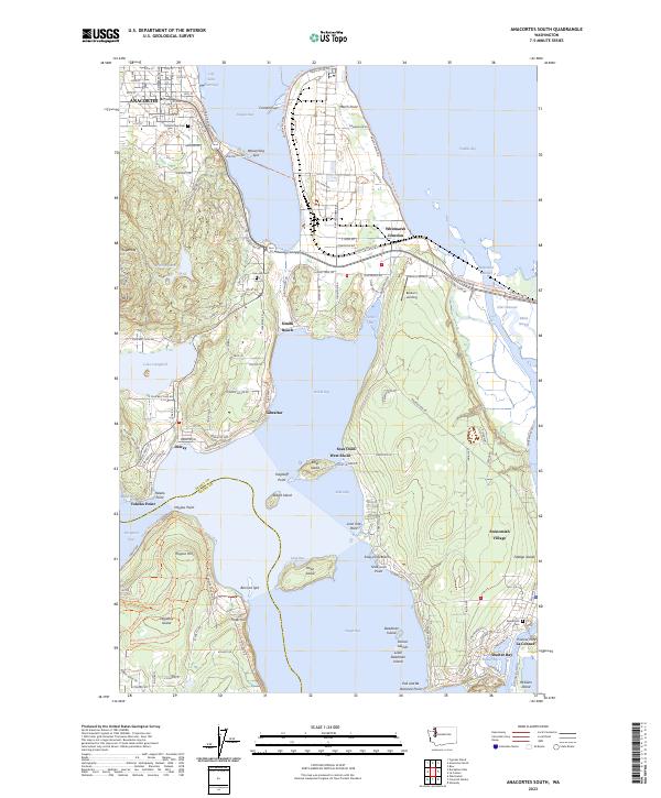
2023 Map of Anacortes South
USGS Topo · Published 2023About this map
Fidalgo Island dominates this coastal landscape where the waters of Padilla Bay, Skagit Bay, and Fidalgo Bay meet. The geography is defined by a complex network of points, spits, and channels, including the narrow Swinomish Channel separating the island from the mainland near La Conner. This coastal corridor features long-established communities like Swinomish Village and the industrial infrastructure at March Point, specifically along Oil King Aly. To the south, the dramatic crossing at Deception Pass connects the area to Whidbey Island. Significant local history and genealogy sites are present, including Swinomish Cem, Grand View Cem, and Fern Hill Cem. The terrain rises from sea-level spits like Weaverling Spit to landmarks such as Mt Erie and Sugarloaf, while recreational trails like the Pacific Northwest National Scenic Trail wind through the hills.
Find a feature on this map
104 named features on this map. Tap any name to fly to it.
Don’t see what you’re looking for? This feature index may not catch every label — zoom into the map to look around manually.
Map Details
Editions of this 2023 Anacortes South Map
This is the sole edition of this map. No revisions or reprints were ever made.
Other maps of this area

1911 · Mount Vernon
USGS Topo · 1:125,000

1918 · Samish Lake
USGS Topo · 1:62,500

1940 · Mt Vernon
USGS Topo · 1:62,500

1943 · Mt Vernon
USGS Topo · 1:62,500

1943 · Deception Pass
USGS Topo · 1:62,500

1943 · Anacortes
USGS Topo · 1:62,500

1951 · Deception Pass
USGS Topo · 1:62,500

1951 · Anacortes
USGS Topo · 1:62,500

1954 · Bow
USGS Topo · 1:24,000

1954 · Samish Lake
USGS Topo · 1:62,500