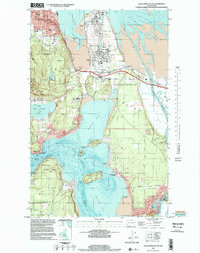
1998 Map of Anacortes South
USGS Topo · Published 2002About this map
Fidalgo Island is characterized by its complex shoreline and industrial activity in this late 20th-century survey. The northern edge highlights the expanding footprint of Anacortes, where the City Refinery and Shell Industrial Waste Disposal facilities sit adjacent to Padilla Bay. Further south, the landscape transitions from industrial zones to recreational and residential areas, including Similk Beach and the heights of Mt Erie Park.
Find a feature on this map
61 named features on this map. Tap any name to fly to it.
Don’t see what you’re looking for? This feature index may not catch every label — zoom into the map to look around manually.
Map Details
Editions of this 1998 Anacortes South Map
This is the sole edition of this map. No revisions or reprints were ever made.
Other maps of this area

1911 · Mount Vernon
USGS Topo · 1:125,000

1918 · Samish Lake
USGS Topo · 1:62,500

1940 · Mt Vernon
USGS Topo · 1:62,500

1943 · Mt Vernon
USGS Topo · 1:62,500

1943 · Deception Pass
USGS Topo · 1:62,500

1943 · Anacortes
USGS Topo · 1:62,500

1951 · Deception Pass
USGS Topo · 1:62,500

1951 · Anacortes
USGS Topo · 1:62,500

1954 · Bow
USGS Topo · 1:24,000

1954 · Samish Lake
USGS Topo · 1:62,500