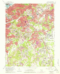
1965 Map of Anacostia
USGS Topo · Published 1971About this map
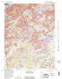
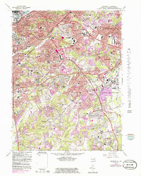
Andrews Air Force Base dominates the eastern landscape of this mid-1960s survey, illustrating the significant military and federal footprint southeast of the nation's capital. The map captures the dense urban expansion from Anacostia and Washington into Prince George's County, showing the evolution of residential developments like Naylor Gardens, Fairfax Village, and Glassmanor. This era is marked by the burgeoning infrastructure of the Capital Beltway and the Anacostia Freeway, which began to reshape local transit and neighborhood connectivity.
Find a feature on this map
175 named features on this map. Tap any name to fly to it.
Don’t see what you’re looking for? This feature index may not catch every label — zoom into the map to look around manually.
Map Details
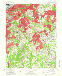
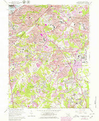
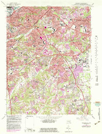
Editions of this 1965 Anacostia Map
6 editions found
Other maps of this area

1890 · Mt. Vernon
USGS Topo · 1:125,000

1891 · Mt. Vernon
USGS Topo · 1:125,000

1892 · Brandywine
USGS Topo · 1:62,500

1894 · Mt. Vernon
USGS Topo · 1:125,000

1895 · Brandywine
USGS Topo · 1:62,500

1897 · Mt. Vernon
USGS Topo · 1:125,000

1899 · Patuxent
USGS Topo · 1:125,000

1900 · Washington
USGS Topo · 1:62,500

1906 · Patuxent
USGS Topo · 1:125,000

1911 · Brandywine
USGS Topo · 1:62,500