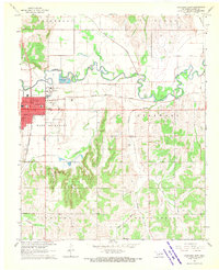
1968 Map of Anadarko East
USGS Topo · Published 1970About this map
Anadarko serves as the focal point for this survey, appearing as a significant crossroads where the Chicago Rock Island and Pacific railroad meets the winding path of the Washita River. The town grid is clearly defined, showing institutional landmarks like Lincoln Sch, East Sch, and the Indian Museum. Cultural and recreational sites are prominent on the outskirts, including the Caddo Country Club and the themed attraction Indian City positioned near the rugged elevations of the South Hills. This landscape illustrates the mid-century development of the Southern Plains, where agriculture and infrastructure follow the fertile river valley and its tributaries like Sugar Creek and Delaware Creek. Genealogists may find value in the specific locations of the Kiowa Cem and Roach Cem, while the various Gaging Stations along the river reflect ongoing water management efforts in the region.
Find a feature on this map
39 named features on this map. Tap any name to fly to it.
Don’t see what you’re looking for? This feature index may not catch every label — zoom into the map to look around manually.
Map Details
Editions of this 1968 Anadarko East Map
This is the sole edition of this map. No revisions or reprints were ever made.
Other maps of this area

1945 · Anadarko
USGS Topo · 1:62,500

1949 · Cement
USGS Topo · 1:62,500

1951 · Fort Cobb
USGS Topo · 1:62,500

1955 · Lawton
USGS Topo · 1:250,000

1955 · Clinton
USGS Topo · 1:250,000

1956 · Laverty
USGS Topo · 1:24,000
1956 · Cyril
USGS Topo · 1:24,000

1956 · Apache
USGS Topo · 1:24,000

1956 · Apache
USGS Topo · 1:62,500
1956 · Cement
USGS Topo · 1:62,500