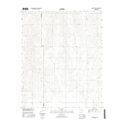
2016 Map of Anadarko NE
USGS Topo · Published 2016About this map
The agricultural landscape of the central Oklahoma plains is defined here by the meeting of Caddo Co Grady Co, marked by the north-south run of Co Line Rd. The small settlement of Dutton serves as a local waypoint within a grid of section-line roads, including Dutton Rd and Cardinal Rd. The terrain is deeply etched by the branching headwaters of Iionine Cr and Jack Hollow Cr, which create complex drainage patterns across the prairie. Local history is anchored by the Friendship Cem in the northeast and Liberty Cem to the east, while the Ionine Cr Site 101 Reservoir provides a modern hydrological anchor near the Caddo County border. The road network, primarily consisting of county routes like Co Rd 1250 and Cs 1220 Rd, reflects the enduring rural structure of this region.
Find a feature on this map
52 named features on this map. Tap any name to fly to it.
Don’t see what you’re looking for? This feature index may not catch every label — zoom into the map to look around manually.
Map Details
Editions of this 2016 Anadarko NE Map
This is the sole edition of this map. No revisions or reprints were ever made.
Other maps of this area

1893 · Buggy Creek
USGS Topo · 1:62,500

1893 · Minco
USGS Topo · 1:62,500

1904 · Chickasha
USGS Topo · 1:125,000

1945 · Anadarko
USGS Topo · 1:62,500

1954 · Oklahoma City
USGS Topo · 1:250,000

1955 · Clinton
USGS Topo · 1:250,000

1957 · Clinton
USGS Topo · 1:250,000

1957 · Oklahoma City
USGS Topo · 1:250,000

1963 · Oklahoma City
USGS Topo · 1:250,000
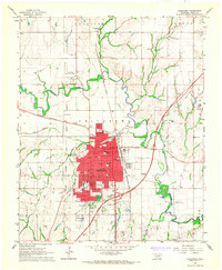
1966 · Chickasha
USGS Topo · 1:24,000