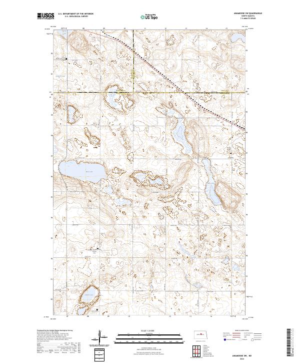
2024 Map of Anamoose SW
USGS Topo · Published 2024About this map
Sheridan County Waterfowl Production Area and its Pierce County counterpart dominate this landscape at the intersection of Sheridan, McHenry, and Pierce Counties. This portion of the North Dakota prairie is characterized by a high density of small wetlands and larger bodies of water including Steele Lake, Mud Lake, and the aptly named Alkali Lake in the south. The area's settlement history is preserved through its spiritual and memorial sites, such as the Ebenezer Congregational Church Cem and Saint Martin Lutheran Cem. The terrain is surveyed through a strict grid of section lines and local roads like 31st ST Ne, which provide access to scattered homesteads and conservation lands. The map also records the Berlin Cem and Martin Baptist Cem, offering essential data for genealogists tracking early families in these rural townships.
Find a feature on this map
31 named features on this map. Tap any name to fly to it.
Don’t see what you’re looking for? This feature index may not catch every label — zoom into the map to look around manually.
Map Details
Editions of this 2024 Anamoose SW Map
This is the sole edition of this map. No revisions or reprints were ever made.
Other maps of this area

1930 · Drake
USGS Topo · 1:62,500

1940 · Aylmer
USGS Topo · 1:62,500

1946 · Sheyenne Lake
USGS Topo · 1:48,000

1947 · Lincoln Valley
USGS Topo · 1:62,500

1947 · Sheyenne Lake
USGS Topo · 1:62,500

1950 · Sheyenne Lake NE
USGS Topo · 1:24,000

1950 · Sheyenne Lake
USGS Topo · 1:24,000

1951 · Martin
USGS Topo · 1:24,000

1951 · Anamoose SW
USGS Topo · 1:24,000

1954 · McClusky
USGS Topo · 1:250,000