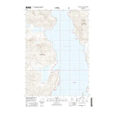
2016 Map of Anchorage A-1 SE
USGS Topo · Published 2016About this map
Prince William Sound dominates this coastal landscape, where the shifting margins of the Columbia Glacier meet the sea. The map documents a rugged wilderness within the Chugach National Forest, characterized by steep glaciated terrain and isolated water bodies like Kadin Lake and Terentiev Lake. Of particular interest to those studying glaciology or coastal changes is the Great Nunatak, a prominent peak surrounded by glacial ice, and the intricate shorelines of Columbia Bay and Heather Bay. This 2016 survey provides a precise record of these glacial features and landforms as they existed in the early twenty-first century, showing the complex boundary between ice and the open waters of the sound.
Find a feature on this map
12 named features on this map. Tap any name to fly to it.
Don’t see what you’re looking for? This feature index may not catch every label — zoom into the map to look around manually.
Map Details
Editions of this 2016 Anchorage A-1 SE Map
This is the sole edition of this map. No revisions or reprints were ever made.
Other maps of this area

1948 · Cordova
USGS Topo · 1:250,000

1951 · Seward
USGS Topo · 1:250,000

1951 · Anchorage
USGS Topo · 1:250,000

1951 · Cordova
USGS Topo · 1:250,000

1951 · Seward D-1
USGS Topo · 1:63,360

1951 · Cordova D-8
USGS Topo · 1:63,360

1952 · Valdez
USGS Topo · 1:250,000

1952 · Seward D-1
USGS Topo · 1:63,360

1952 · Cordova D-8
USGS Topo · 1:63,360

1953 · Seward
USGS Topo · 1:250,000