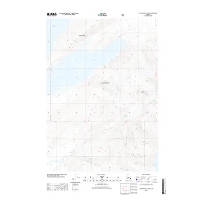
2013 Map of Anchorage A-2 NW
USGS Topo · Published 2013About this map
Chugach National Forest encompasses this coastal Alaskan landscape, where massive ice fields meet the inlets of Prince William Sound. The 2013 survey reveals the dramatic topography of the Dora Keen Range and Mount Castner, showing the intricate boundaries between glacial ice and open water. Massive flows from Yale Glacier, Dartmouth Glacier, Ranney Glacier, and the smaller Baby Glacier dominate the terrain, feeding into the deep waters of Harvard Arm and Yale Arm. At the southern edge of the sheet, the Coghill River drains toward Unakwik Inlet, marking a transition from the high peaks to the sea. This record serves as a precise baseline for the coastal ice margins and glacial extents in the early 21st century, illustrating the raw geography of the Unorganized Borough before shifting environmental patterns further alter these frozen landmarks.
Find a feature on this map
11 named features on this map. Tap any name to fly to it.
Don’t see what you’re looking for? This feature index may not catch every label — zoom into the map to look around manually.
Map Details
Editions of this 2013 Anchorage A-2 NW Map
This is the sole edition of this map. No revisions or reprints were ever made.
Other maps of this area

1951 · Anchorage
USGS Topo · 1:250,000

1960 · Anchorage A-2
USGS Topo · 1:63,360

1960 · Anchorage A-3
USGS Topo · 1:63,360

1960 · Anchorage B-3
USGS Topo · 1:63,360

1960 · Anchorage B-2
USGS Topo · 1:63,360

1962 · Anchorage
USGS Topo · 1:250,000

1979 · Anchorage
USGS Topo · 1:250,000

2013 · Anchorage B-2 SW
USGS Topo · 1:25,000
2013 · Anchorage B-3 SE
USGS Topo · 1:25,000
2013 · Anchorage A-2 NE
USGS Topo · 1:25,000