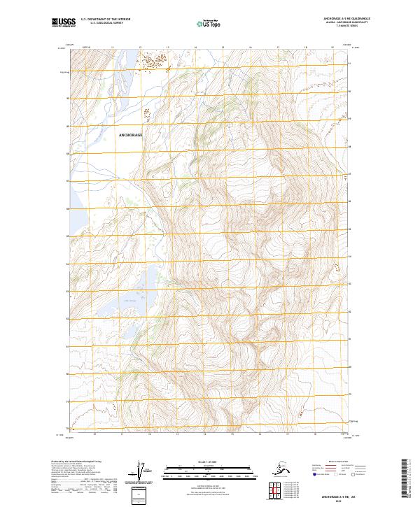
2023 Map of Anchorage A-5 NE
USGS Topo · Published 2023About this map
Lake Fork Knik River flows through the western portion of this quadrangle, shaping the drainage patterns and topography north of Lake George. Located within the Anchorage municipality, this landscape is defined by its dramatic elevation changes and glacially influenced hydrology. The map provides a high-resolution look at the complex contouring of the Chugach Mountains, where the natural interface between the massive water bodies and the steep vertical relief dictates the geography. The presence of these specific glacial and river features highlights the dynamic environmental forces at work in this part of Alaska, offering essential data for understanding the region's physical shifts and water resources.
Find a feature on this map
7 named features on this map. Tap any name to fly to it.
Don’t see what you’re looking for? This feature index may not catch every label — zoom into the map to look around manually.
Map Details
Editions of this 2023 Anchorage A-5 NE Map
This is the sole edition of this map. No revisions or reprints were ever made.
Other maps of this area

1951 · Anchorage
USGS Topo · 1:250,000

1960 · Anchorage A-5
USGS Topo · 1:63,360

1960 · Anchorage A-4
USGS Topo · 1:63,360

1960 · Anchorage B-5
USGS Topo · 1:63,360

1960 · Anchorage B-4
USGS Topo · 1:63,360

1962 · Anchorage
USGS Topo · 1:250,000

1979 · Anchorage
USGS Topo · 1:250,000

1994 · Anchorage B-4
USGS Topo · 1:63,360
1994 · Anchorage B-5
USGS Topo · 1:63,360
2013 · Anchorage B-4 SW
USGS Topo · 1:25,000