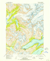
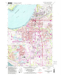
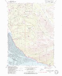
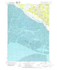
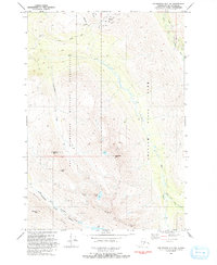
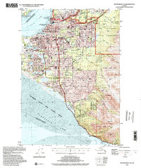
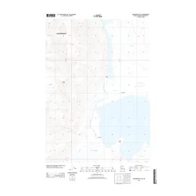
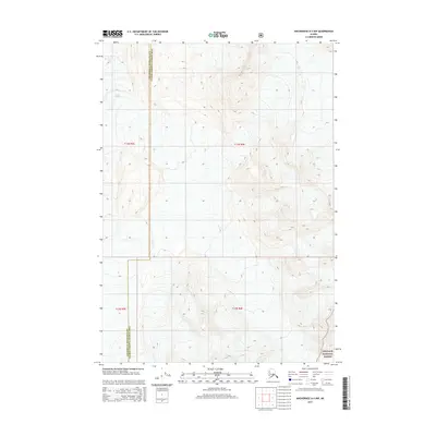
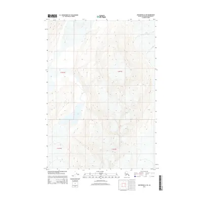
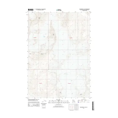
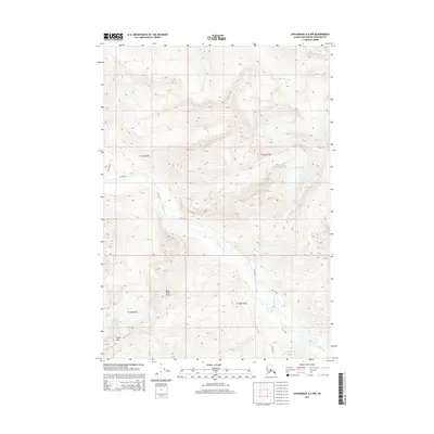
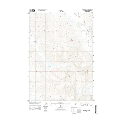
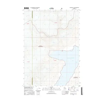
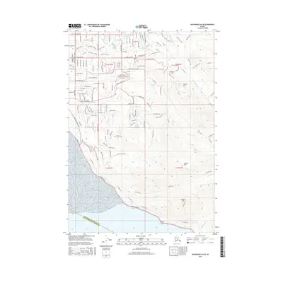
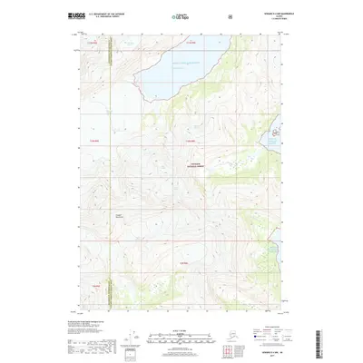
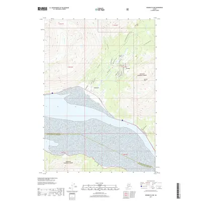
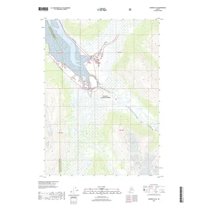
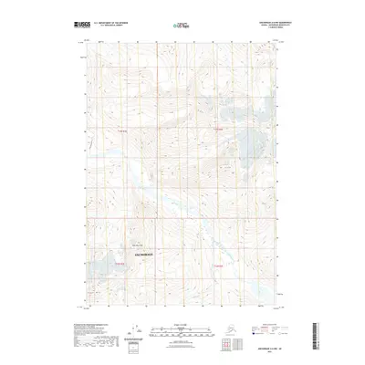
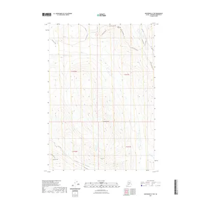
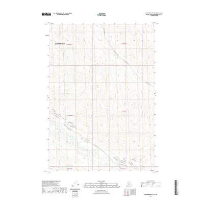
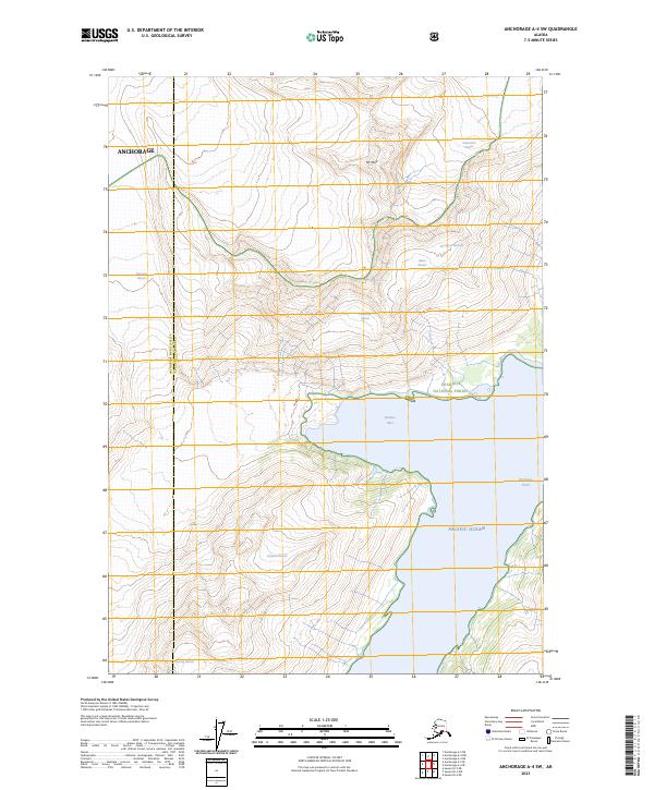
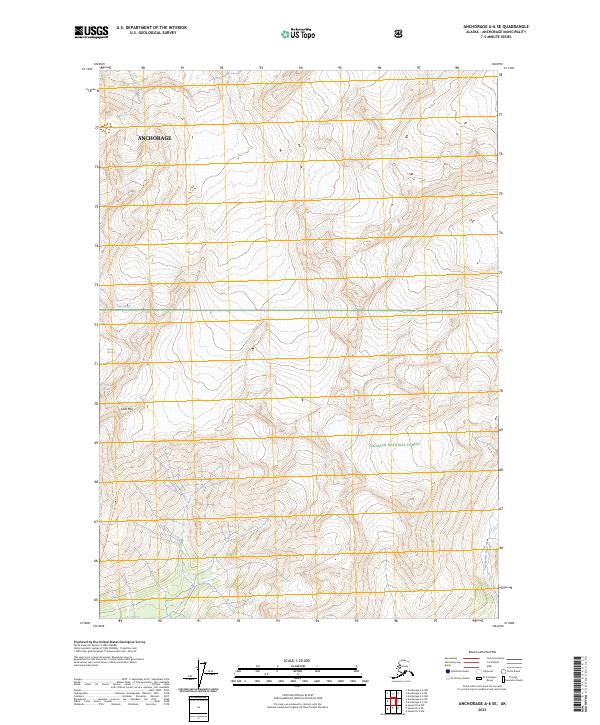
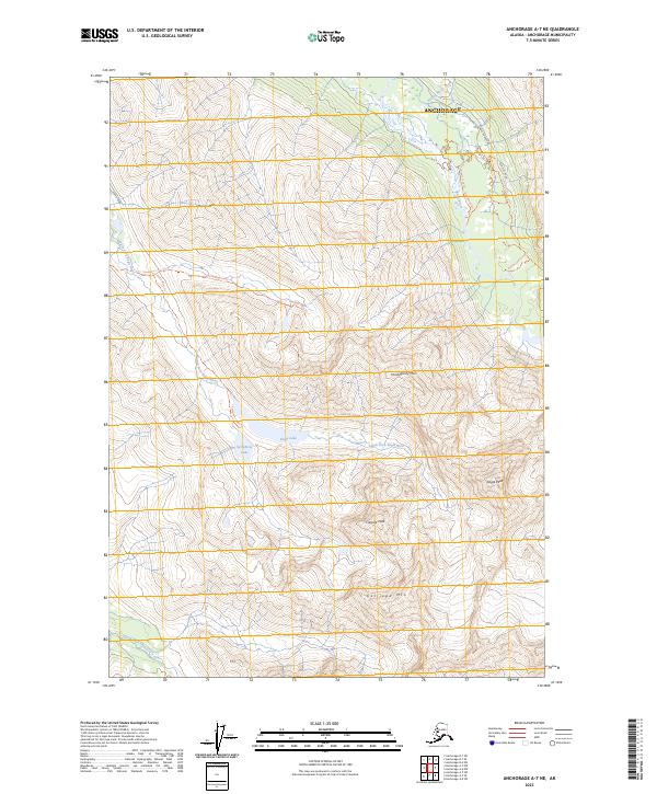
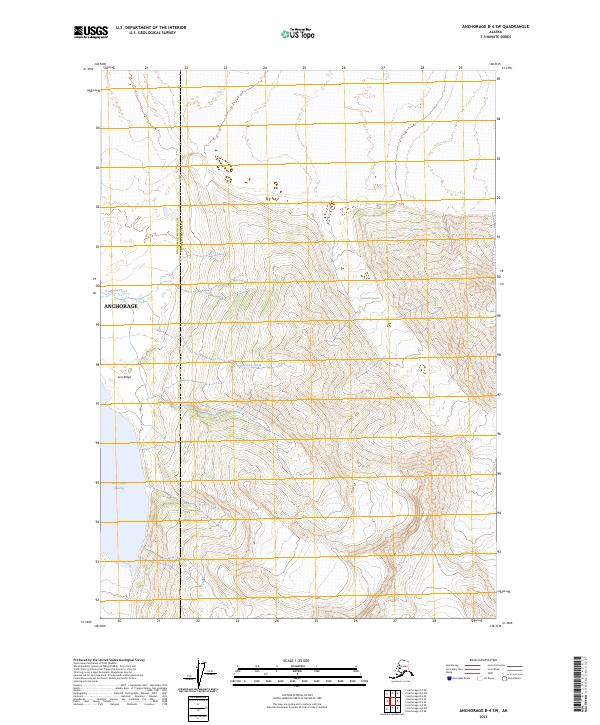
1993 Map of Anchorage A-7 NE
USGS Topo · Published 1993About this map
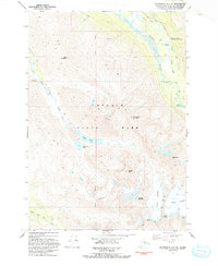
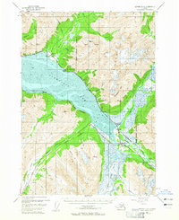
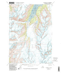
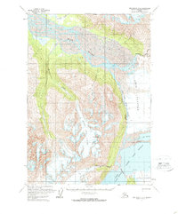
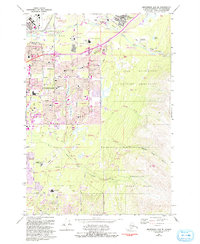
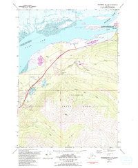
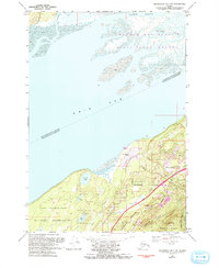
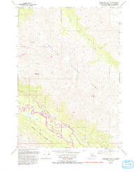
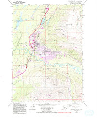
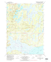
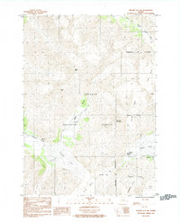
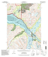
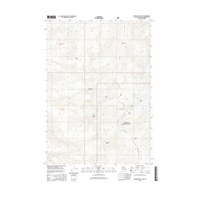
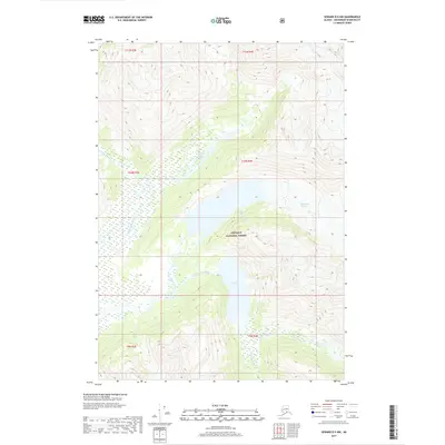
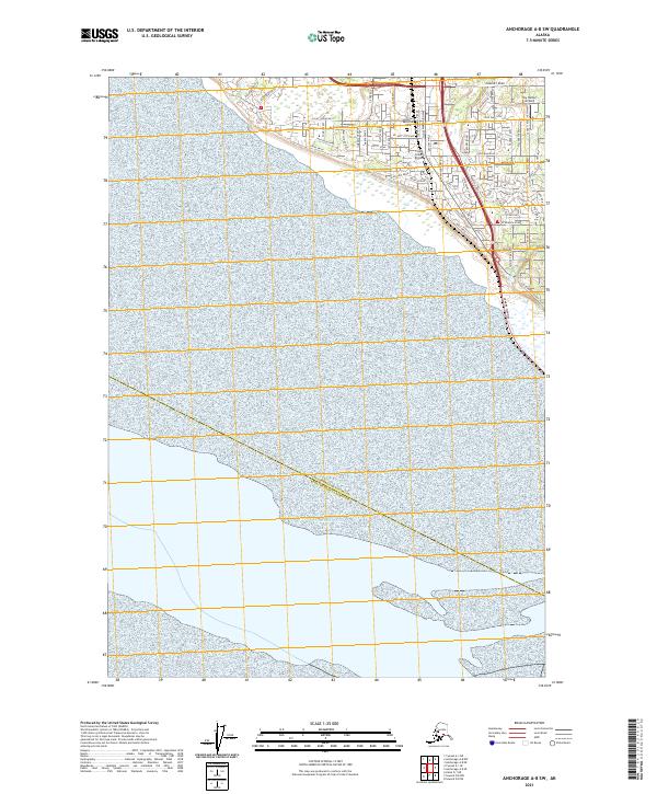
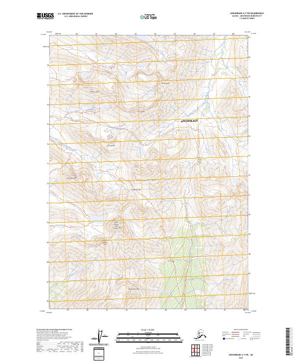
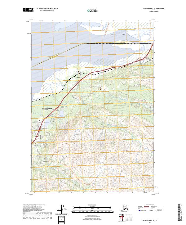
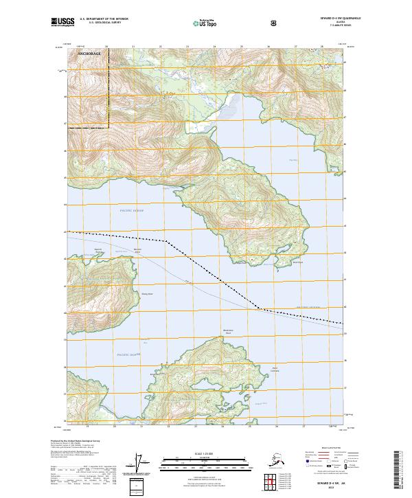
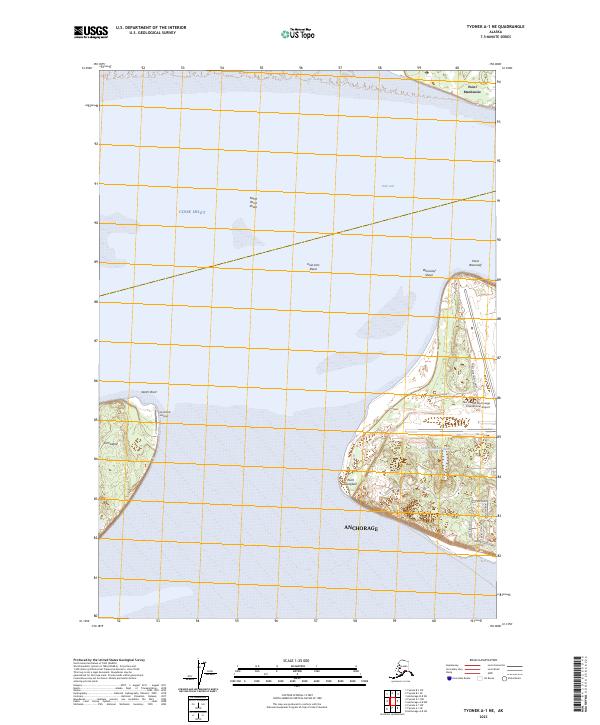
Chugach State Park dominates this early 1990s landscape, illustrating the meeting point of glacial activity and protected wilderness near Anchorage. The topographic data highlights a complex alpine system where Flute Glacier and Organ Glacier feed high-altitude drainage basins. The presence of the Iditarod National Historic Trail running along the Eagle River underscores the area's significance as a travel corridor, connecting the coast to the interior long before its modern recreational use.
Find a feature on this map
26 named features on this map. Tap any name to fly to it.
Don’t see what you’re looking for? This feature index may not catch every label — zoom into the map to look around manually.
Map Details
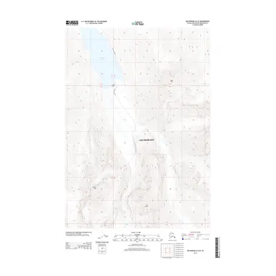
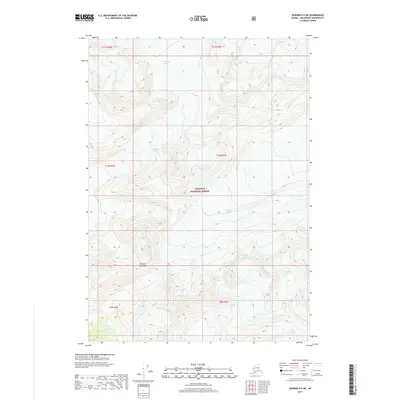
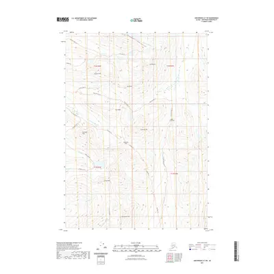
Editions of this 1993 Anchorage A-7 NE Map
This is the sole edition of this map. No revisions or reprints were ever made.
Historical Maps of Anchorage Through Time
141 maps found
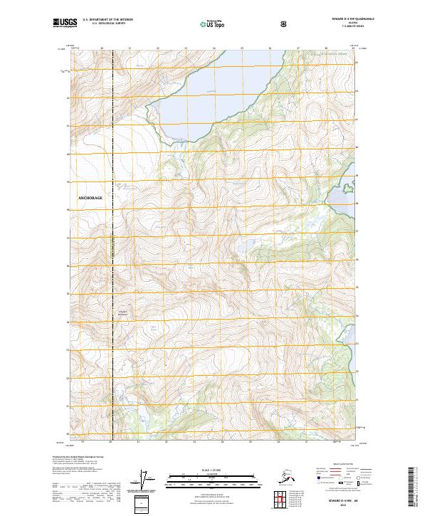
1951 Seward D-4
Anchorage Borough, AK
1951 Seward D-5
Anchorage Borough, AK
1951 Seward D-6
Anchorage Borough, AK
1951 Tyonek A-1
Anchorage Borough, AK
1952 Anchorage A-8
Anchorage Borough, AK
1952 Seward D-4
Anchorage Borough, AK
1952 Seward D-5
Anchorage Borough, AK
1952 Seward D-6
Anchorage Borough, AK
1952 Tyonek A-1
Anchorage Borough, AK
1953 Anchorage A-8
Anchorage Borough, AK
1960 Anchorage A-4
Anchorage Borough, AK
1960 Anchorage A-5
Anchorage Borough, AK
1960 Anchorage A-6
Anchorage Borough, AK
1960 Anchorage A-7
Anchorage Borough, AK
1960 Anchorage B-4
Anchorage Borough, AK
1960 Anchorage B-5
Anchorage Borough, AK
1960 Anchorage B-6
Anchorage Borough, AK
1960 Anchorage B-7
Anchorage Borough, AK
1979 Anchorage A-7 NE
Anchorage Borough, AK
1979 Anchorage A-8 NE
Anchorage Borough, AK
1979 Anchorage A-8 NW
Anchorage Borough, AK
1979 Anchorage A-8 SE
Anchorage Borough, AK
1979 Anchorage A-8 SW
Anchorage Borough, AK
1979 Anchorage B-7 NE
Anchorage Borough, AK
1979 Anchorage B-7 NW
Anchorage Borough, AK
1979 Anchorage B-7 SE
Anchorage Borough, AK
1979 Anchorage B-7 SW
Anchorage Borough, AK
1979 Anchorage B-8 NW
Anchorage Borough, AK
1979 Anchorage B-8 SE
Anchorage Borough, AK
1979 Tyonek A-1 NE
Anchorage Borough, AK
1984 Seward D-5 SE
Anchorage Borough, AK
1984 Seward D-5 SW
Anchorage Borough, AK
1984 Seward D-6 NE
Anchorage Borough, AK
1984 Seward D-6 Nw
Anchorage Borough, AK
1984 Seward D-6 SE
Anchorage Borough, AK
1993 Anchorage A-7 NE
Anchorage Borough, AK
1993 Anchorage A-7 NW
Anchorage Borough, AK
1993 Anchorage A-8 SW
Anchorage Borough, AK
1994 Anchorage A-6
Anchorage Borough, AK
1994 Anchorage A-7
Anchorage Borough, AK
1994 Anchorage A-8
Anchorage Borough, AK
1994 Anchorage B-4
Anchorage Borough, AK
1994 Anchorage B-5
Anchorage Borough, AK
1994 Anchorage B-6
Anchorage Borough, AK

1994 Anchorage B-7
Anchorage Borough, AK
1994 Seward D-6
Anchorage Borough, AK
1995 Seward D-4
Anchorage Borough, AK
1995 Seward D-5
Anchorage Borough, AK
2013 Anchorage B-4 SW
Anchorage Borough, AK
2013 Anchorage B-5 SE
Anchorage Borough, AK

2013 Anchorage B-5 SW
Anchorage Borough, AK
2013 Anchorage B-6 SE
Anchorage Borough, AK
2013 Anchorage B-6 SW
Anchorage Borough, AK
2013 Anchorage B-7 SE
Anchorage Borough, AK
2015 Anchorage A-4 NW
Anchorage Borough, AK
2015 Anchorage A-5 NE
Anchorage Borough, AK

2015 Anchorage A-5 NW
Anchorage Borough, AK
2015 Anchorage A-6 NE
Anchorage Borough, AK
2015 Anchorage A-6 NW
Anchorage Borough, AK
2015 Anchorage A-7 NE
Anchorage Borough, AK

2015 Anchorage A-7 NW
Anchorage Borough, AK
2015 Anchorage A-8 NE
Anchorage Borough, AK
2015 Anchorage B-7 SW
Anchorage Borough, AK
2015 Anchorage B-8 SE
Anchorage Borough, AK
2016 Anchorage A-4 SW
Anchorage Borough, AK
2016 Anchorage A-5 SE
Anchorage Borough, AK
2016 Anchorage A-5 SW
Anchorage Borough, AK
2016 Anchorage A-6 SE
Anchorage Borough, AK
2016 Anchorage A-6 SW
Anchorage Borough, AK
2016 Anchorage A-7 SE
Anchorage Borough, AK
2016 Anchorage A-7 SW
Anchorage Borough, AK
2016 Anchorage A-8 NW
Anchorage Borough, AK
2016 Anchorage A-8 SE
Anchorage Borough, AK
2016 Anchorage B-7 NE
Anchorage Borough, AK
2016 Anchorage B-7 NW
Anchorage Borough, AK
2016 Anchorage B-8 NW
Anchorage Borough, AK
2017 Seward D-4 NW
Anchorage Borough, AK
2017 Seward D-5 NE
Anchorage Borough, AK
2017 Seward D-5 NW
Anchorage Borough, AK
2017 Seward D-6 NE
Anchorage Borough, AK
2017 Seward D-6 NW
Anchorage Borough, AK
2018 Seward D-4 SW
Anchorage Borough, AK
2018 Seward D-5 SE
Anchorage Borough, AK
2018 Seward D-5 SW
Anchorage Borough, AK
2018 Seward D-6 SE
Anchorage Borough, AK
2019 Anchorage A-8 NW
Anchorage Borough, AK
2019 Anchorage A-8 SW
Anchorage Borough, AK
2019 Tyonek A-1 NE
Anchorage Borough, AK
2021 Anchorage A-6 NW
Anchorage Borough, AK
2021 Anchorage A-6 SE
Anchorage Borough, AK
2021 Anchorage A-6 SW
Anchorage Borough, AK
2021 Anchorage A-7 NE
Anchorage Borough, AK
2021 Anchorage A-7 NW
Anchorage Borough, AK
2021 Anchorage A-7 SW
Anchorage Borough, AK
2021 Anchorage A-8 NE
Anchorage Borough, AK
2021 Anchorage A-8 SE
Anchorage Borough, AK
2021 Anchorage A-8 SW
Anchorage Borough, AK
2021 Anchorage B-6 SE
Anchorage Borough, AK
2021 Anchorage B-7 NE
Anchorage Borough, AK
2021 Anchorage B-7 NW
Anchorage Borough, AK
2021 Anchorage B-7 SE
Anchorage Borough, AK
2021 Anchorage B-7 SW
Anchorage Borough, AK
2021 Anchorage B-8 SE
Anchorage Borough, AK
2023 Anchorage A-4 NW
Anchorage Borough, AK
2023 Anchorage A-4 SW
Anchorage Borough, AK
2023 Anchorage A-5 NE
Anchorage Borough, AK
2023 Anchorage A-5 NW
Anchorage Borough, AK
2023 Anchorage A-5 SE
Anchorage Borough, AK
2023 Anchorage A-5 SW
Anchorage Borough, AK
2023 Anchorage A-6 NE
Anchorage Borough, AK
2023 Anchorage A-6 NW
Anchorage Borough, AK
2023 Anchorage A-6 SE
Anchorage Borough, AK
2023 Anchorage A-6 SW
Anchorage Borough, AK
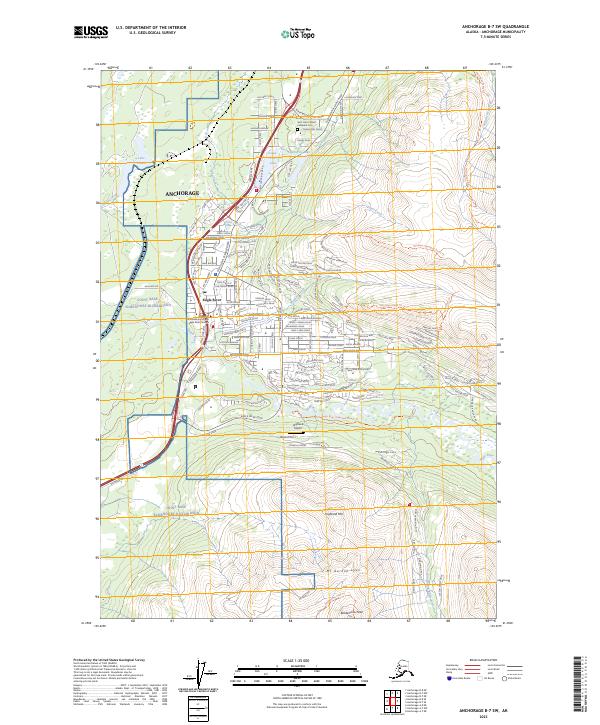
2023 Anchorage A-7 NE
Anchorage Borough, AK
2023 Anchorage A-7 NW
Anchorage Borough, AK
2023 Anchorage A-7 SE
Anchorage Borough, AK
2023 Anchorage A-7 SW
Anchorage Borough, AK
2023 Anchorage A-8 NE
Anchorage Borough, AK
2023 Anchorage A-8 NW
Anchorage Borough, AK
2023 Anchorage A-8 SE
Anchorage Borough, AK
2023 Anchorage B-4 SW
Anchorage Borough, AK
2023 Anchorage B-5 SE
Anchorage Borough, AK
2023 Anchorage B-5 SW
Anchorage Borough, AK
2023 Anchorage B-6 SE
Anchorage Borough, AK
2023 Anchorage B-6 SW
Anchorage Borough, AK
2023 Anchorage B-7 NE
Anchorage Borough, AK
2023 Anchorage B-7 NW
Anchorage Borough, AK
2023 Anchorage B-7 SE
Anchorage Borough, AK
2023 Anchorage B-7 SW
Anchorage Borough, AK
2023 Anchorage B-8 NW
Anchorage Borough, AK
2023 Anchorage B-8 SE
Anchorage Borough, AK
2023 Seward D-4 NW
Anchorage Borough, AK
2023 Seward D-4 SW
Anchorage Borough, AK
2023 Seward D-5 NE
Anchorage Borough, AK
2023 Seward D-5 NW
Anchorage Borough, AK
2023 Seward D-5 SE
Anchorage Borough, AK
2023 Seward D-5 SW
Anchorage Borough, AK
2023 Seward D-6 NE
Anchorage Borough, AK
2023 Seward D-6 NW
Anchorage Borough, AK
2023 Seward D-6 SE
Anchorage Borough, AK
2023 Tyonek A-1 NE
Anchorage Borough, AK